The Two RV Gypsies
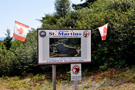
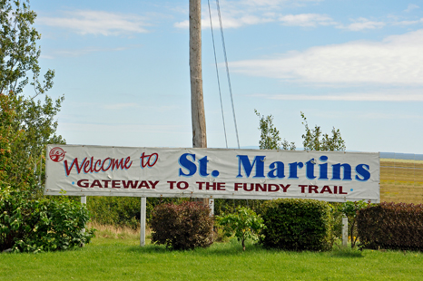
at The Village of St. Martins,
New Brunswick, Canada
The heart of the Bay of Fundy
|
The Two RV Gypsies at The Village of St. Martins, |
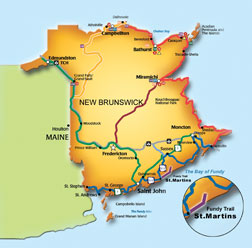
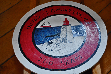
| St. Martins is a Canadian village in Saint John County, New Brunswick and was originally known as Quaco meaning haunt of the hooded seal. The picturesque community is just east of Saint John and is situated on the Bay of Fundy. Through the 19th century, St. Martins was an important shipbuilding centre. Tourism is now the major industry. | |
 |
|
 |
 |
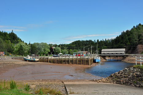
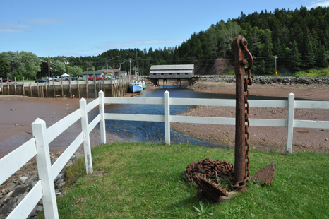
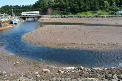
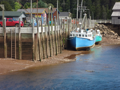
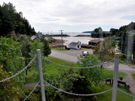
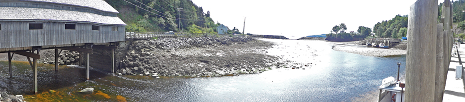
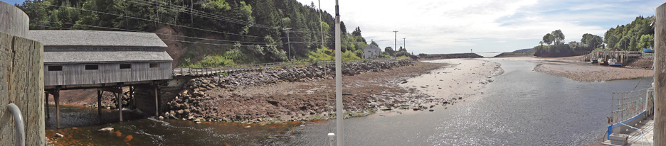
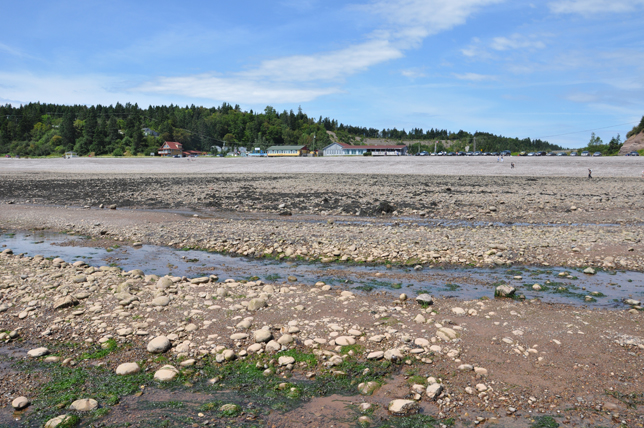
| The Highest tides in the world govern everyday activity in the Village of St. Martins, where the fishing fleet must depart and return on the high tide. The low tide, as shown below, leaves boats sitting in the mud. | |
 |
 |
 |
|
 |
|
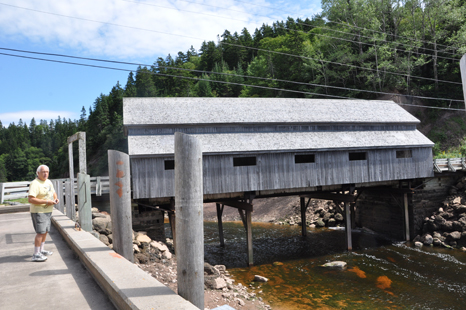
Two
twin covered bridges can be found in St .Martins. Just around the corner
from the wharf one bridge takes you up to Orange Hill and down the scenic
back roads. The drive from the other bridge goes to a beautiful beach
and the famous caves of St. Martins., then on to the entrance of the Fundy
Trail. This is the way that the two RV Gypsies went - keep scrolling down
for photos. |
|
 |
 |
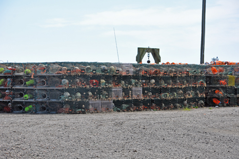
Below:
Lots of lobster traps |
|
 |
|
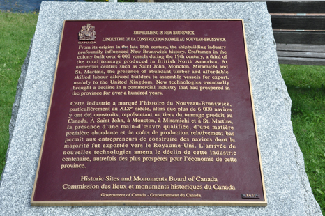
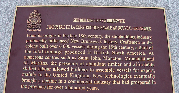
| Through
the 19th century, St. Martins was an important shipbuilding centre. |
|
 |
 |
|
|
 |
|
| Below:
The St. Martins Interpretive Center |
|
 |
 |
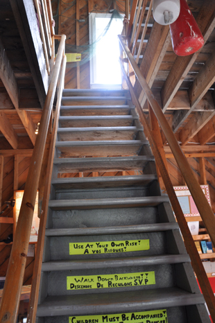
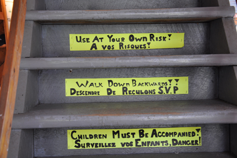
The
staircase was marked and instructed visitors that they MUST
walk down the stairs backwards! |
|
 |
 |
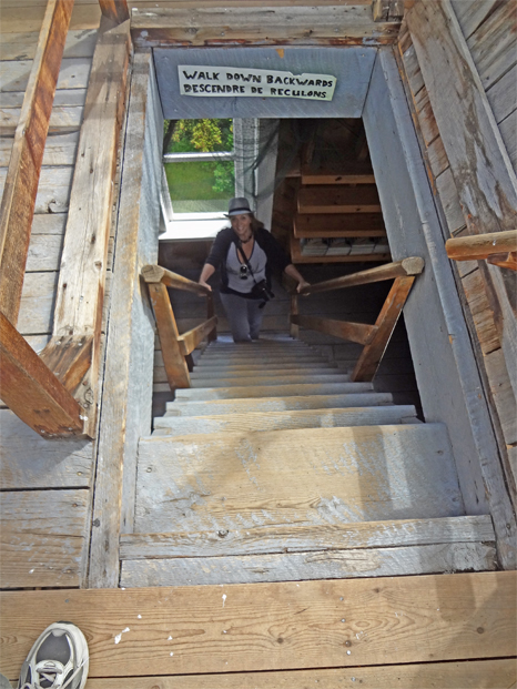
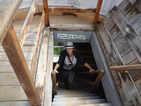
| Below:
Lee Duquette was already at the first landing of the stairs and turned
around to photograph Karen Duquette climbing UP the staircase. |
|
 |
 |
Below:
The view of the outdoors from the top of the staircase. |
|
 |
|
Below:
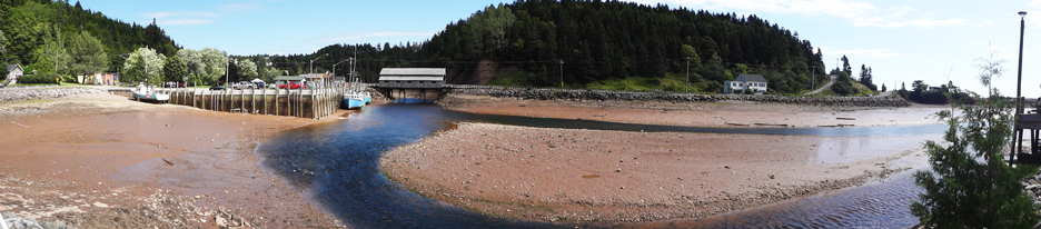
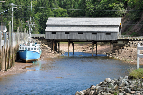
Lee Duquette viewed the covered bridge and the low tide located across
the street from the St. Martins Interpretive Center. |
|
 |
 |
 |
|
 |
|
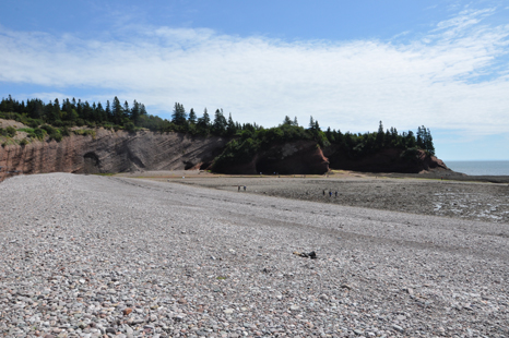
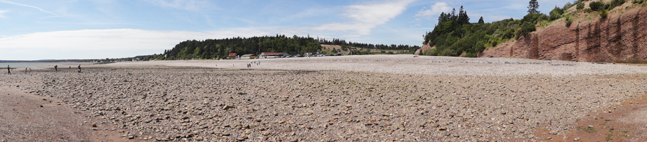
Below: The view
of the beach from restaurant - Sea Caves and cliffs |
|
 |
 |
 |
|
 |
|
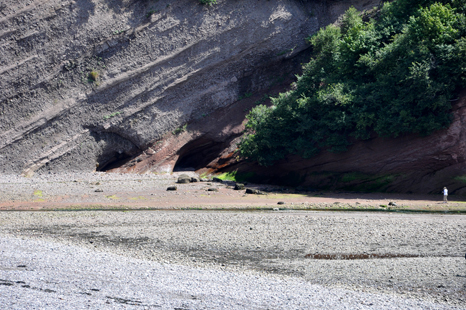
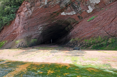
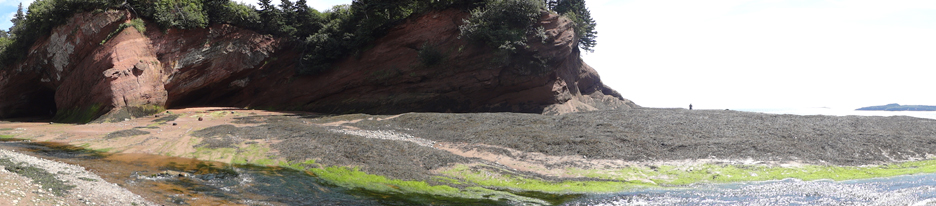
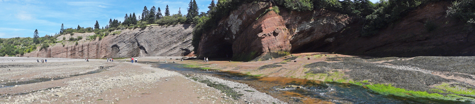
| Below: After a light lunch of delicious seafood chowder and clams at the beach restaurant; the two RV Gypsies enjoyed a walk along the beach; where time and tides have carved echoing caves in the sandstone cliffs. | |
 |
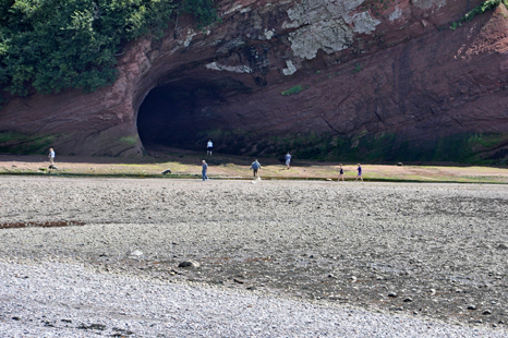 |
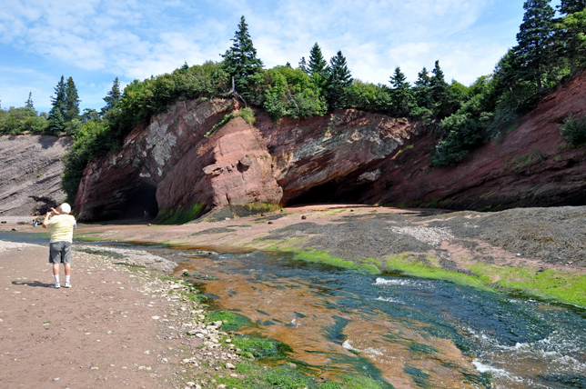
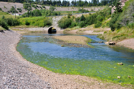
| Below: The two RV Gypsies did not realize that it was necessary to cross a very colorful stream in order to get to the cave. Many people did remove their shoes and socks to do so, but Lee Duquette did not want to, so Karen Duquette did not either, but later regretted that decision. If they ever return here, Karen will do this and whatever else, even if Lee does not want to. | |
 |
|
 |
|
 |
|
 |
|
| Below: It was a windy day and Karen Duquette had to remove her hat in order to keep it from blowing away in the wind. | |
 |
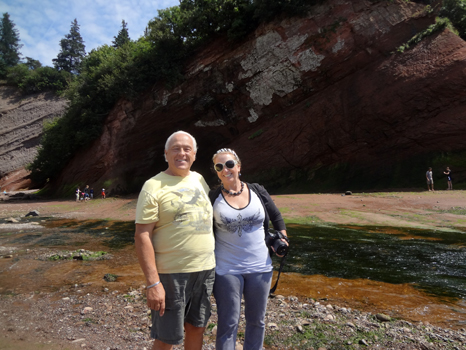 |
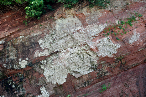
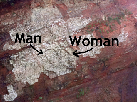
| Below is a close up of the marking on the cave seen in the above photos. The two RV Gypsies noticed the image of a man and a woman in the markings. | |
 |
 |
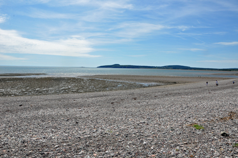
| The two RV Gypsies took a minute to look back towards the restaurant. Walking on this beach at low tide was a wonderful experience. However walking through the rocks and streams of water was not always easy. | |
 |
|
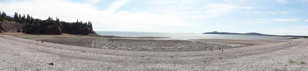
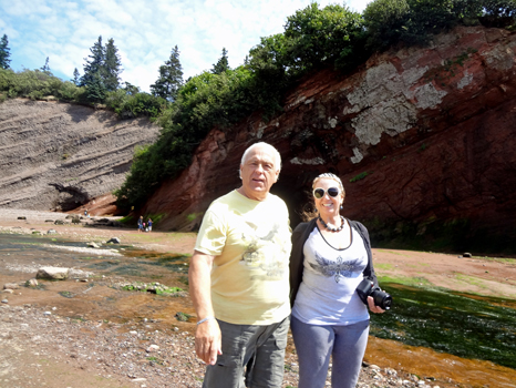
| Below;
One last photo before continuing on to the Bay of Fundy trail. |
|
 |
|
 The
two RV Gypsies visited 10 areas of New Brunswick listed
in the menu below. You may view them in any order you wish. The page you
are on has been grayed out (not underlined) and can NOT be chosen from here.
There is also a link to PEI at the bottom of this page. The
two RV Gypsies visited 10 areas of New Brunswick listed
in the menu below. You may view them in any order you wish. The page you
are on has been grayed out (not underlined) and can NOT be chosen from here.
There is also a link to PEI at the bottom of this page. |
|
|
|
|
|
|
|
|
|
| |
|
 After
you have seen all 10 of the sections above - Continue on to the next adventure
of the two RV Gypsies 2011 travels in Canada -Prince
Edward Island After
you have seen all 10 of the sections above - Continue on to the next adventure
of the two RV Gypsies 2011 travels in Canada -Prince
Edward Island |
|