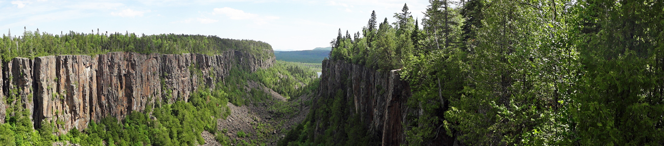
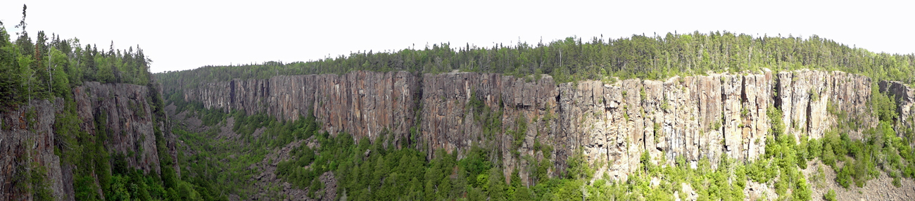
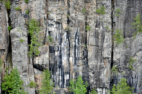
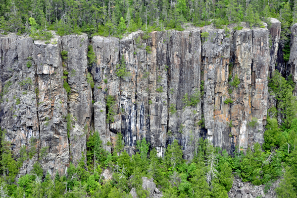
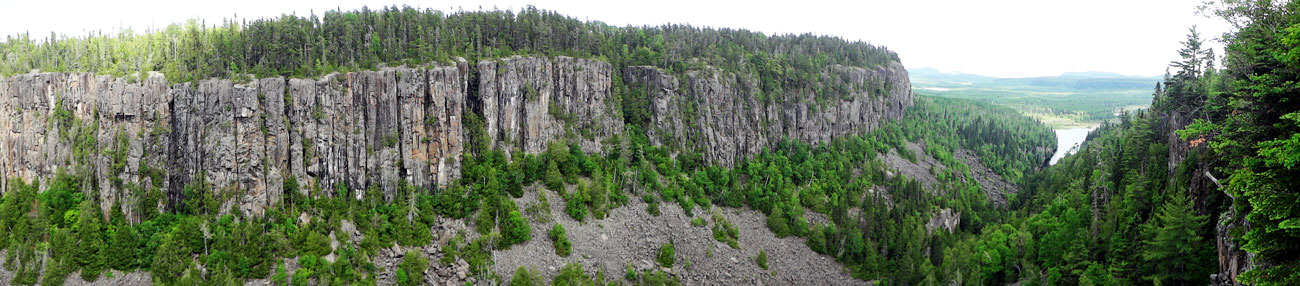
Ouimet Canyon's (pronounced we-met) history dates back over a billion years. Hot molten rock rose up from deep within the earth. Below the earth's surface, the magna flowed horizontally to form a huge flat formation called a sill. As the magna cooled, it became a hard rock called diabase. Over several million years, the rocks above the diabase eroded away. Further cooling and exposure resulted in extensive cracking and fracturing the diabase sill. There are several other theories on how the canyon formed. |
|
|
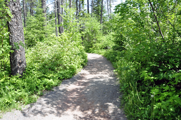
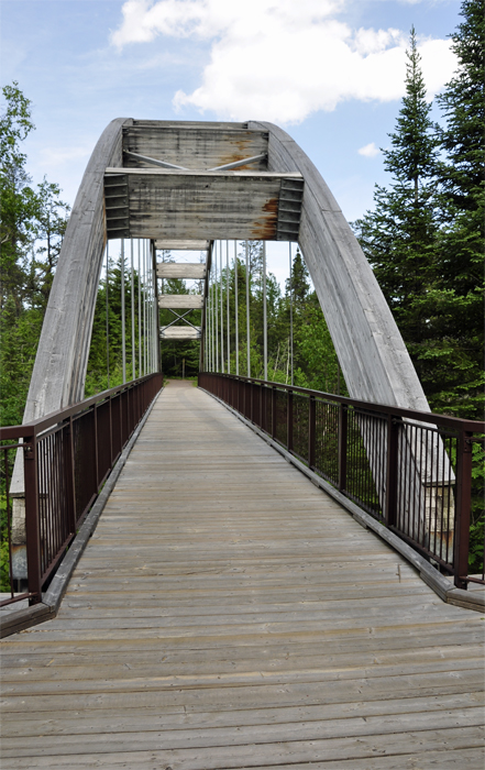
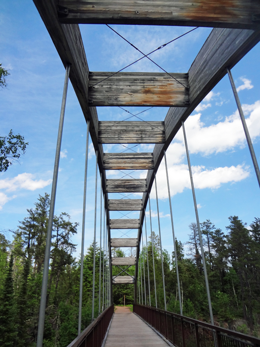
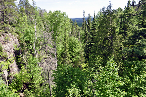
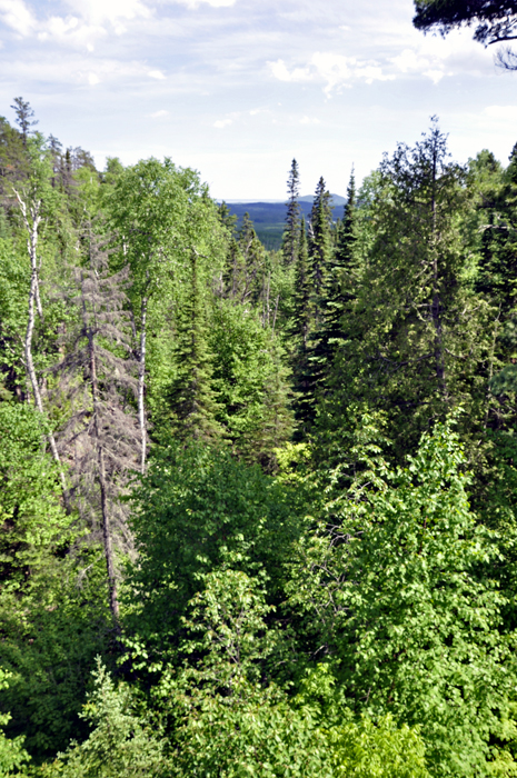
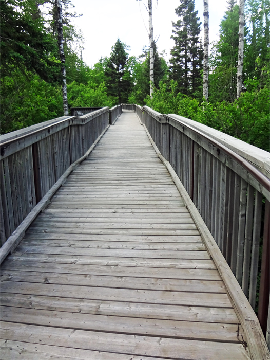
After a brief walk on a narrow
dirt path through the woods, Lee and Karen Duquette came to a very unique,
attractive wooden bridge. |
|
|
Below: Arriving at the overlook, Lee and Karen Duquette marveled
at the view.
|
|
|
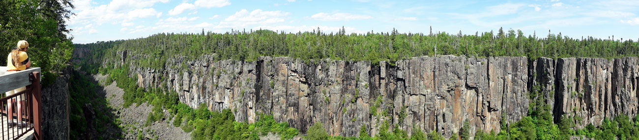
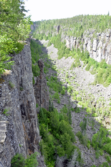
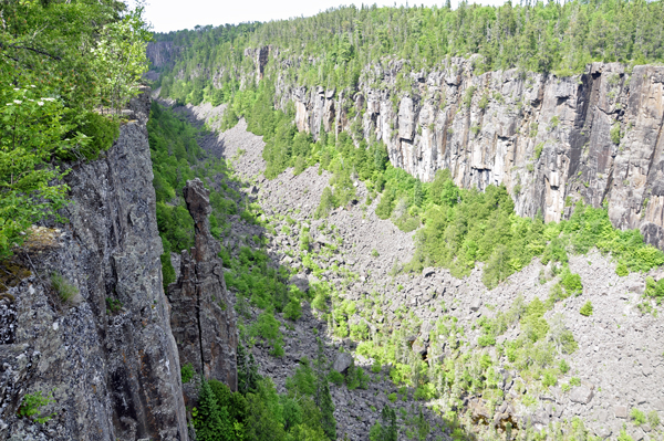
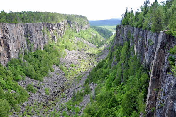
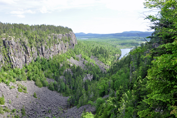
Below: This geologic phenomenon is one of the most spectacular landscapes found in eastern Canada. The Canyon measures 1.9 miles in length and 500 feet across. Protected beneath the boulders, 350 feet below on the canyon floor, are arctic plant species typically found north of the park. To protect this fragile plant community, access to the canyon floor is prohibited. |
|
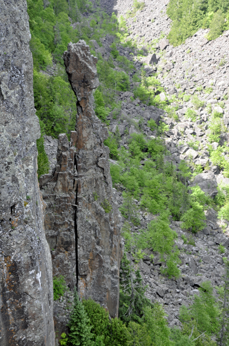
 Legend of the Indian Head: A long time ago, there was a giant Omett. He helped Nanabijou make mountains and lakes. Omett fell in love with Nanabijou's daughter Naiomi. One day, Omett was moving a mountain when part of it fell off and killed Naiomi. Omett quickly hid Naiomi. Nanabijou desperately looked for his daughter. When he sensed something underground, he sent a thunderbolt to split open the ground which created a canyon and he discovered his daughter at its bottom. He buried her there and to punish Omett he turned him into stone and put him on the canyon walls to watch Naiomi's grave forever. Legend of the Indian Head: A long time ago, there was a giant Omett. He helped Nanabijou make mountains and lakes. Omett fell in love with Nanabijou's daughter Naiomi. One day, Omett was moving a mountain when part of it fell off and killed Naiomi. Omett quickly hid Naiomi. Nanabijou desperately looked for his daughter. When he sensed something underground, he sent a thunderbolt to split open the ground which created a canyon and he discovered his daughter at its bottom. He buried her there and to punish Omett he turned him into stone and put him on the canyon walls to watch Naiomi's grave forever.
|
|
|
Ouimet Canyon is a large gorge in the Canadian province of Ontario, about 37 miles northeast of Thunder Bay in Dorion Township. The gorge is 330 feet deep, 490 feet wide and 1.2 miles in length, protected in the Ouimet Canyon Provincial Park.
There is a walkway consisting of boardwalks and trails, which leads to viewing platforms overlooking the canyon.
The canyon was named after a former railway station, Ouimet Station, which used to be located nearby on the Canadian Pacific Railway line. The station itself was named after the Canadian Minister of Public Works from 1892 to 1896, Joseph-Aldric Ouimet.
Ouimet Canyon Provincial Park covers an area of 3 square miles around the canyon. This is a day-use park; there are no camping facilities. |
|
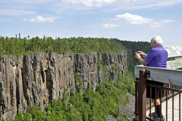
Below: The two RV Gypsies enjoyed
the view of Indian Head and the canyon. |
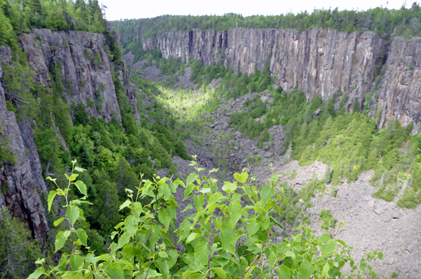
The view of the canyon
from the other side of the lookout, |
|
|
|
|
|
|
|
|
|
As Lee and Karen Duquette
walked to this lookout at Ouimet Canyon, they wondered where the directional
signs were because at times they were NOT sure which path to take. As
Lee Duquette looked down into the canyon, he saw a yellow sign with
directional arrows on it. Yes, his eyesight was just that good. After
Karen Duquette took the photo of the yellow spot, she enlarged it and
could indeed see directional arrows on the yellow sign. What a shame
that someone would throw the sign down into the canyon. |
|
Below: Lee and Karen Duquette
walked on the wooden boardwalk, until once again, they had to figure
out which way to go. As they have often encountered, nobody else was
around. |
|
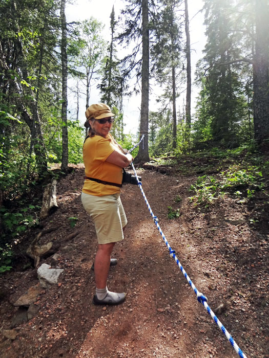
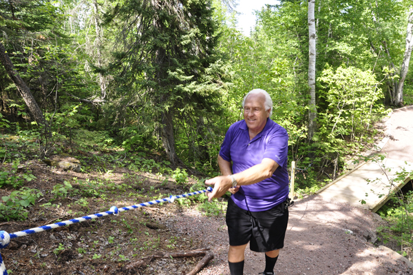
Below: Karen
Duquette actually thought that using the rope to get up the short, but
steep hill was FUN! |
|
|
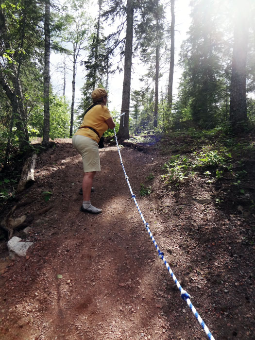
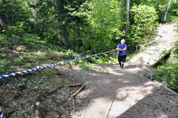
Below: The hill was short,
but steep. The two RV Gypsies were amazed how easy it was to get up
the steep hill with the help of the rope that was there. In all the
hiking they have done, this was their first time using a rope. |
|
|

 AFTER
you have seen all six sections above, please continue on to
AFTER
you have seen all six sections above, please continue on to 


