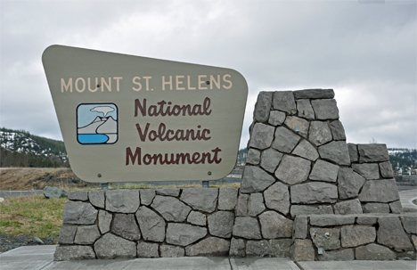
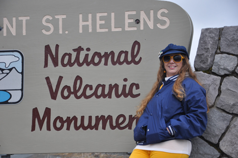
| The Mount St. Helens National Volcanic Monument
was established by Congress in 1982 to protect natural features and processes
and provide access for recreation, research and education. It is internationally
renowned for the study of earth processes and ecosystem recovery following
large-scale disturbance. |
|
|
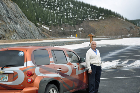
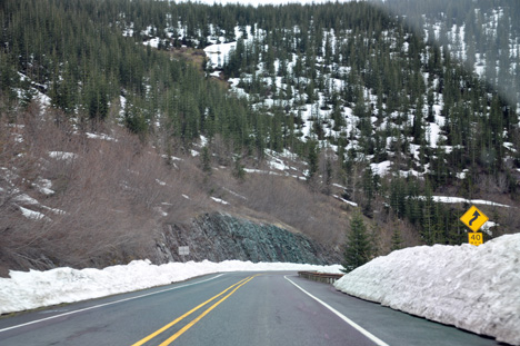
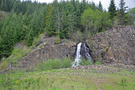
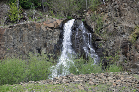
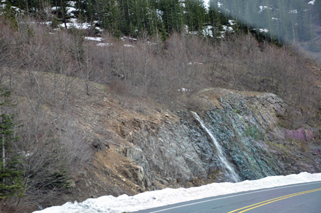
| Below: Lee Duquette, the snow alongside the road,
and several small waterfalls glistening down the mountainside. |
|
|
|
|
|
|
|
May 18, 1980 Eruption
Facts |
 At 8:32 a.m. on May 18, 1980, a 5.1 magnitude earthquake
shook Mount St. Helens, triggering a massive explosion.
At 8:32 a.m. on May 18, 1980, a 5.1 magnitude earthquake
shook Mount St. Helens, triggering a massive explosion. |
|
The release of gases trapped inside the volcano sent 1,300 vertical feet
of mountaintop rocketing outward to the north. Where did the top of the
volcano go?
Not up in ash, but down into the valleys below. |
|
The mountain lost 1,300 feet of height and 0.67 cubic miles of total volume. |
|
Super heated ash roared 60,000 feet into a cloudless blue
sky - winds reached 670 miles per hour and temperatures reached 800 degrees
Fahrenheit. |
|
The eruption leveled 230-square miles of forest in less than ten (10) minutes.
|
|
The eruption began with a massive landslide (debris avalanche) that buried
14 miles of river valley to an average depth of 150 feet. |
|
The landslide released trapped magma and gas, producing a sideways explosion
(lateral blast) of hot rock and ash killing trees up to 17 miles north of
the volcano. |
|
Cement-like slurries of glacial melt water and boulders scoured and buried
streams draining the volcano. |
|
A vertical ash eruption rose to a height of 15-miles above the crater and
continued for 9-hours. Ash drifted to the northeast. |
|
Fiery avalanches of pumice and hot gasses (called pyroclastic flows) flowed
into the valley north of the crater. |
|
Fifty-seven (57) people were killed including USGS Scientist David Johnston,
namesake of Johnston Ridge Observatory. |
|
Elk, deer and other wildlife were obliterated. |
|
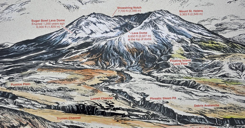
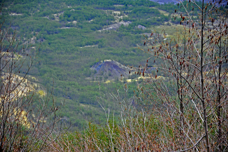
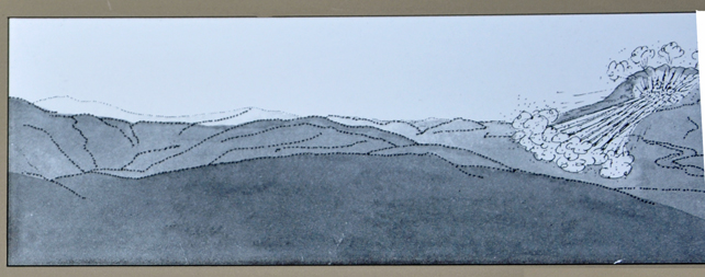
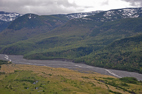
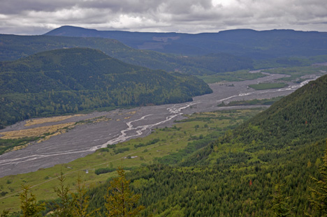
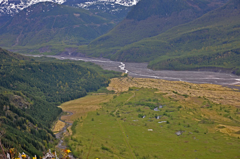
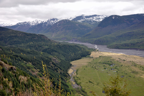
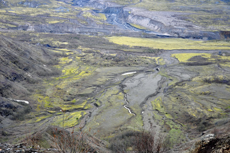
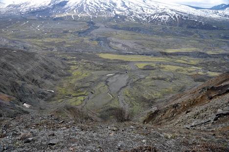
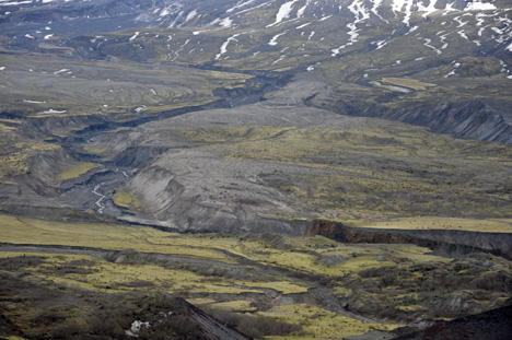
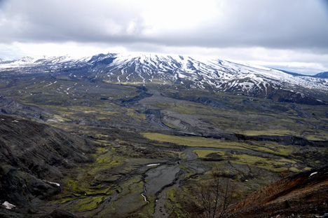
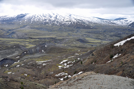
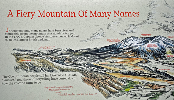
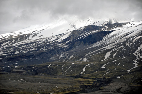
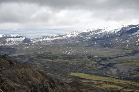
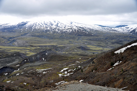
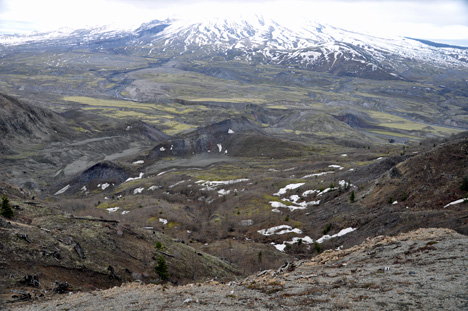
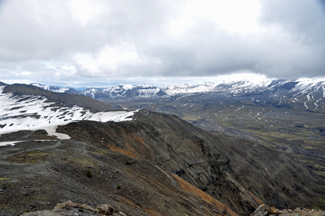
| It is not easy to define exactly what is in
each of the following photos; therefore a chart of the area is shown above,
so you can compare each of the photos below with the chart above. |
|
|
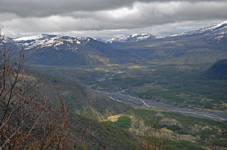
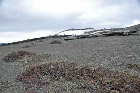
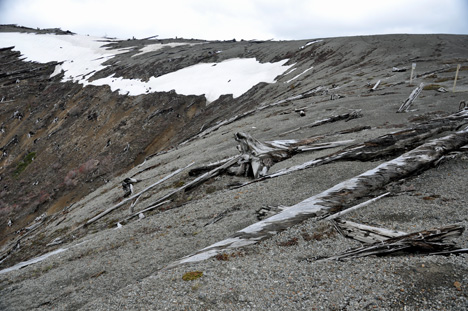
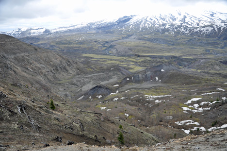
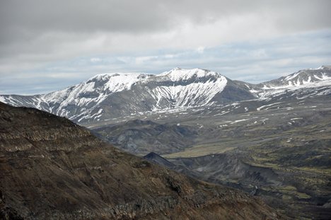
| Below: Ponder the dramatic change that took
place on May 18, 1980, and the more subtle changes that have taken place
each day since then. These photos were taken by the two RV Gypsies on May
14, 2009 almost 29 years to the day after the event. |
|
|
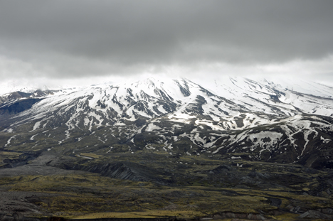
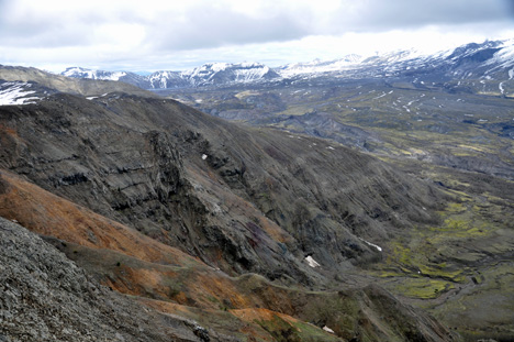
| IMAGINE: The lateral blast slammed into Johnston
Ridge with such force that whole forests were knocked down and carried away. |
|
|
|
|
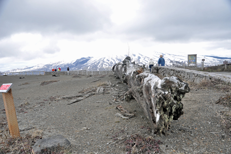
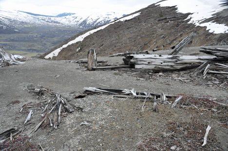
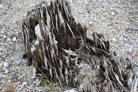
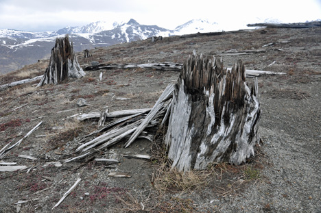
| Below: The stumps below tell a tale of the
blast. These were once trees that stood 150 feet tall and were surrounded
by a beautiful forest of green and growing trees. |
|
|
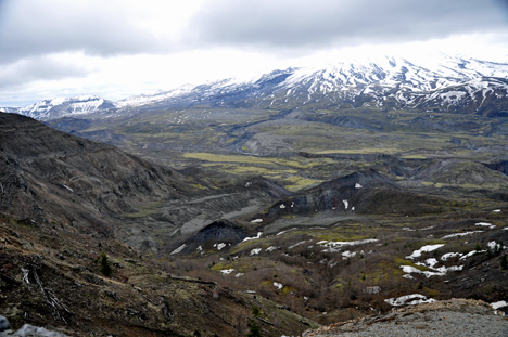
Below: The north side of
the mountain collapsed when the 5/1 magnitude earthquake rumbled beneath
Mount St. Helens. |
| |
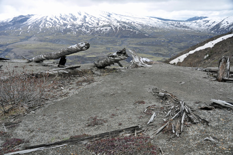
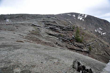
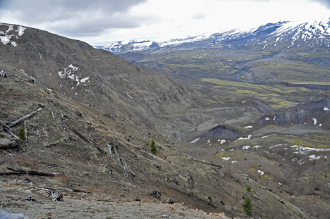
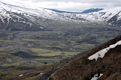
| Below: Momentum carried part of the avalanche
up and over Johnston Ridge, just a few hundred yards from these photos below. |
|
|
Below: In less than 10 minutes,
the avalanche swept 14 miles down the South Coldwater and North Toutle
River Valleys. |
|
|
|
|
|
|
|
|
|
|
|
| Throughout time, many names have been given
and many stories have been told about this mountain. In the 1700's Captain George Vancouver
named it Mount St. Helens, after a British diplomat. The Cowlitz Indian
people call her LAW-WE-LAT-KLAH, "Smoker", and through storytelling
have passed down how the volcano came to be..... |
|
|
|
|
|
|
|
|
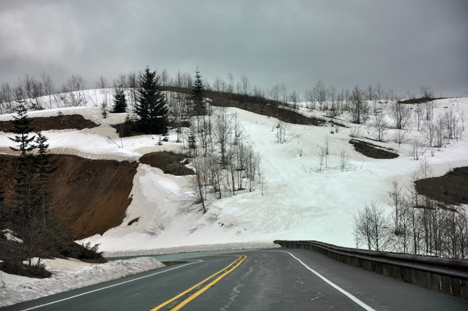
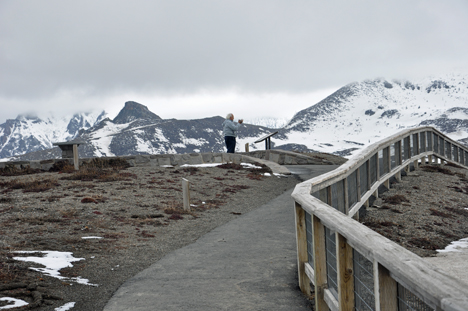
Below: Lee Duquette on Johnston
Ridge, elevation 4,314 feet - - and the snowy roads below Johnston Ridge |
|
|
From the damaged area where Lee is standing,
Mt. Saint Helens is actually another five miles straight ahead. |
|
|
|
| Forever changing over 200 square miles of rich
forest land into a gray, lifeless landscape, the 1980 eruption of Mt. St.
Helens has had an impact so powerful, you have to see it to believe it.
The two RV Gypsies were totally in awe of the devastation that they observed.
Live life to the fullest - tomorrow is not guaranteed to anyone. |


 Continue on in the year 2009 when Finally, after traveling
about 2-1/2 months from Florida to the state of Washington in 2009, the
two RV Gypsies have reached
Continue on in the year 2009 when Finally, after traveling
about 2-1/2 months from Florida to the state of Washington in 2009, the
two RV Gypsies have reached