Lee
and Karen Duquette
walked the steep path up Sassafras Mountain
and stood in SC and NC at the same time
(in northern Pickens County, SC near Rossman, NC)
August 16, 2022
|
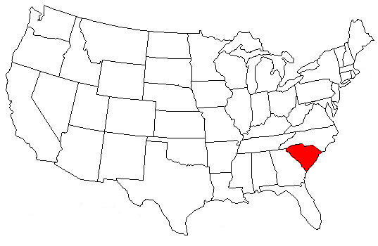
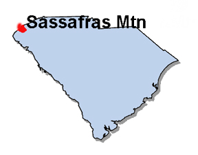
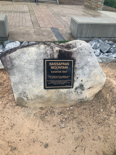
Poised on the
South Carolina and North Carolina border, Sassafras Mountain is about
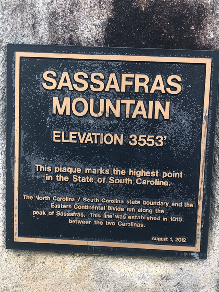
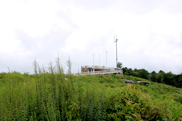
20 miles north of Pickens, South Carolina. The tower on Sassafras Mountain
is South Carolina’s highest point at 3,553 feet above sea level. It
officially opened to the public on April 22, 2019, Earth Day.
Lee and Karen Duquette went to The observation Tower to marvel at the
view of three states and the Blue Ridge Mountains.
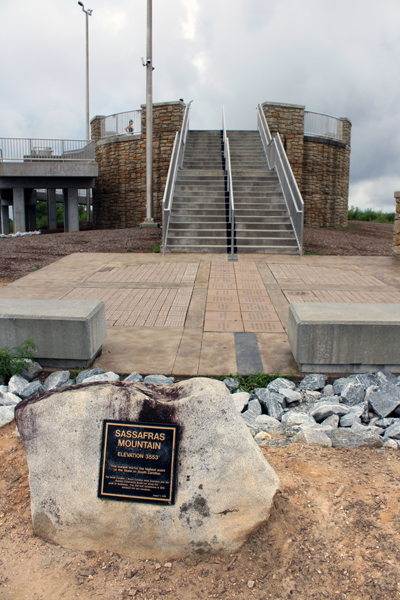
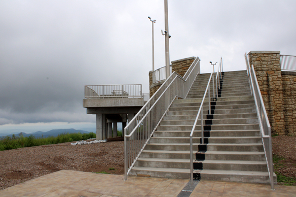
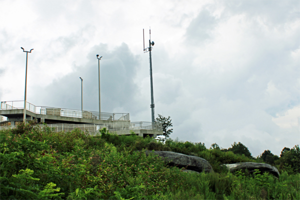
The Sassafras Tower has a natural stone appearance and sits on the South
Carolina/North Carolina line. The tower sits 11 feet above the mountain’s
highest point, and the top of the tower is 44 feet in diameter. There
is a mobility-impaired trail and ramp, along with a paved road that
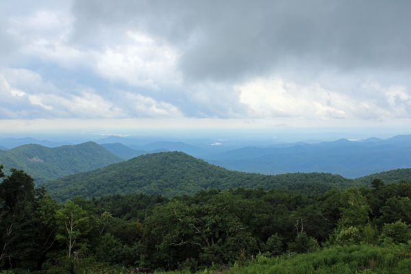
travels to the top. On a clear day from the top of the tower, a visitor
can see 30-50 miles into the states of South Carolina, North Carolina
and Georgia. However, it was quite cloudy when Lee and Karen Duquette were
here.
Note: Seven miles north of Pickens is the wonderfully named town of
Rocky Bottom, which is the highest settlement in the whole of South
Carolina, sitting at the foot of Sassafras Mountain. Rocky Bottom has
an elevation of 1,750 feet above sea level. |
 |
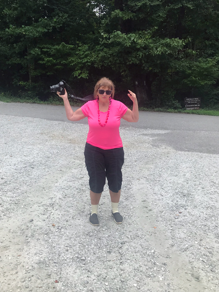
Below: Lee and Karen Duquette on the path up to the observation tower. It was quite steep. |
 |
 |
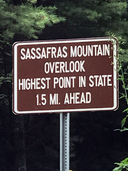
Below: Sassafras
Mountain elevation sign and tower |
 |
 |
 |
 |
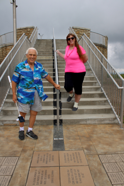
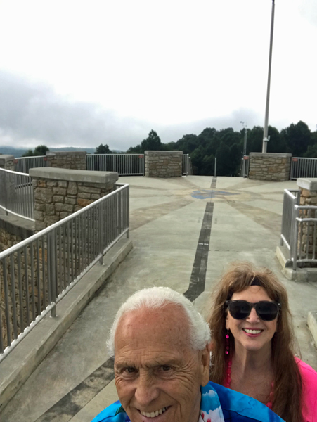
Below: Lee and Karen Duquette ready to
climb up the stairs to the observation tower. Lee Duquette stood in
South Carolina and Karen Duquette stood in North Carolina (as per the
black divider line and railing). Standing in different states at the
same time - not the first time they have done that, but it was the first
time here. |
 |
 |
 |
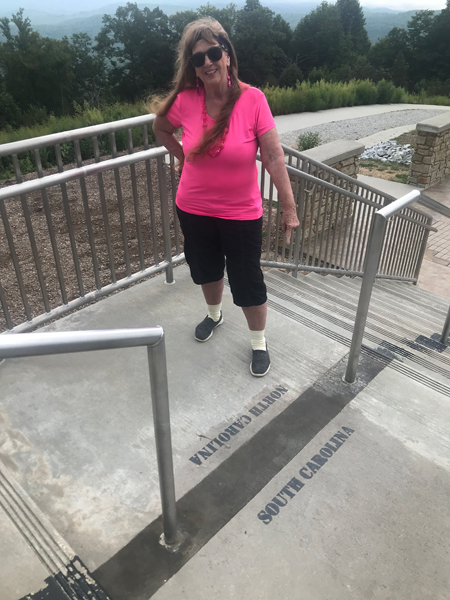
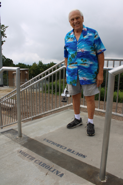
Shown Below:
When Lee and Karen Duquette reached the top of the stairs they photographed
each other with Karen Duquette in North Carolina and Lee Duquette in
South Carolina. |
 |
 |
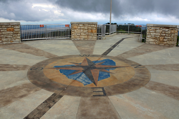
Below: The compass
rose etched into the Sassafras Mountain Tower shows the South Carolina-North
Carolina state line running through the structure. |
 |
 |
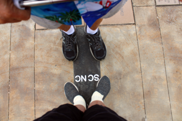
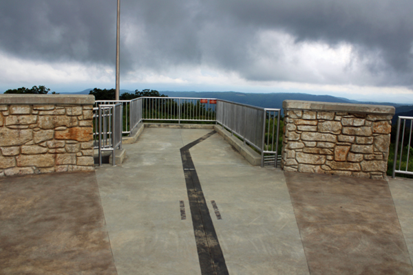
Below: The
divider line continued to cross the tower floor and even onto the path
down below. |
 |
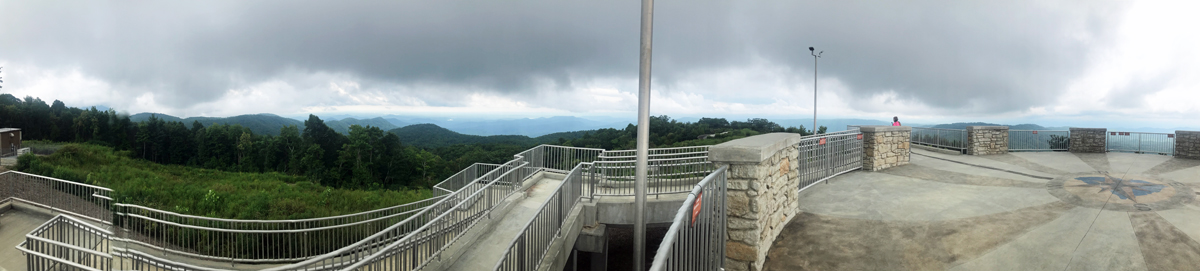
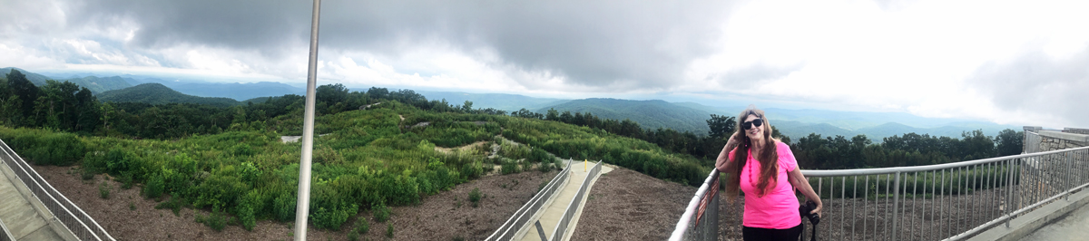
The panorama
below shows the easy-access ramp up plus the compass rose and Karen
Duquette enjoying the view. |
 |
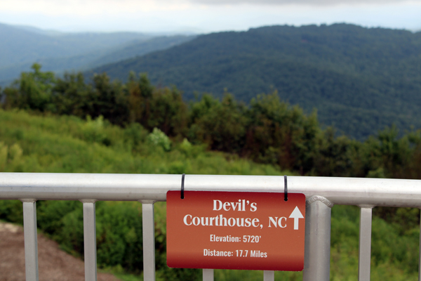
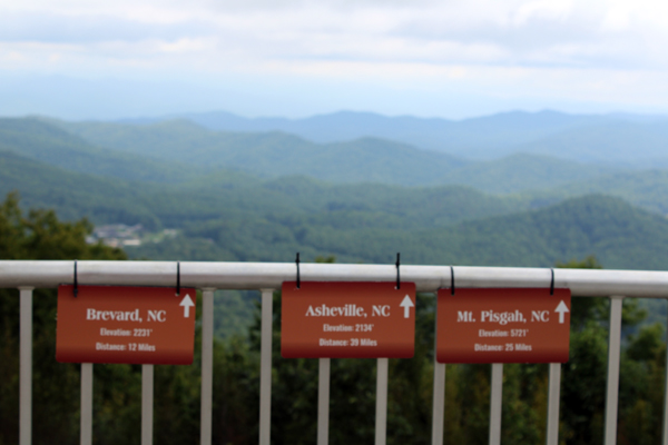
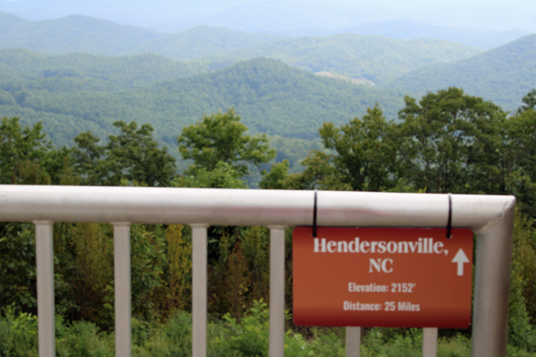
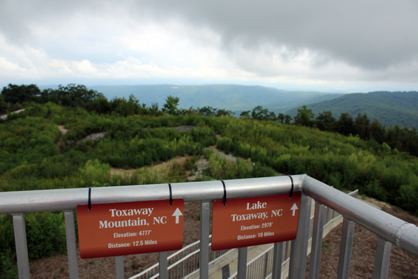
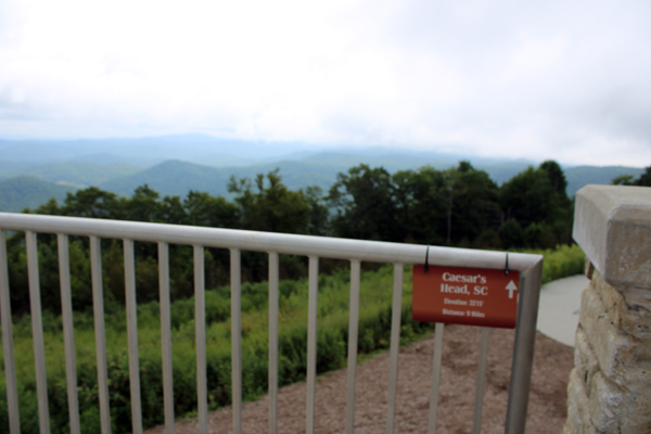
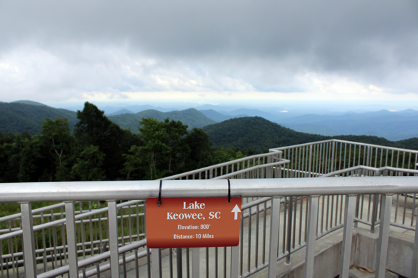
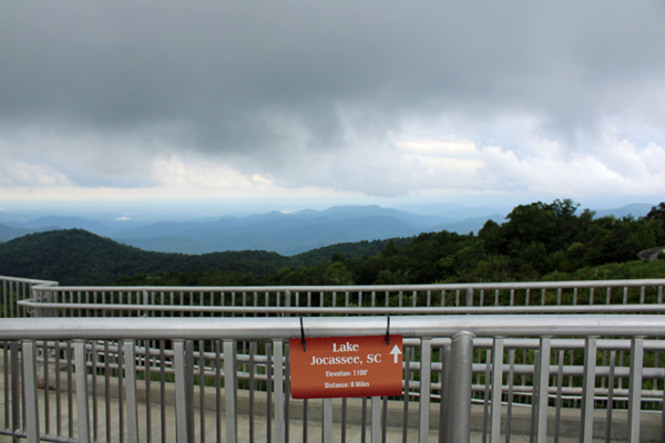
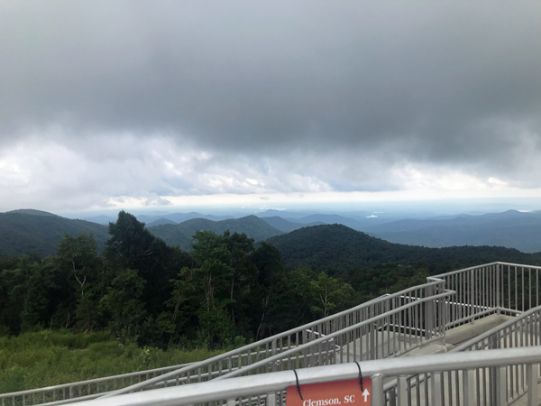
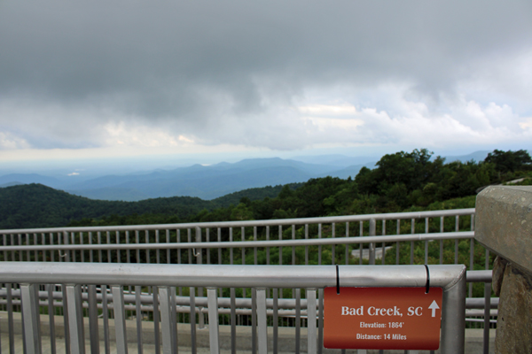
Below: Karen Duquette walked
around the edge of the tower and photographed each directional sign
and matching view. It was not a sunny day, so the photos are far from
great. But all photos make for good memories. |
 |
 |
|
 |
 |
 |
 |
 |
 |
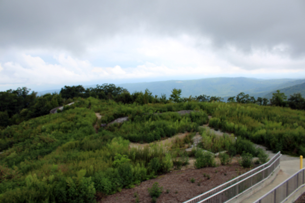
Below: The
Scenery below and The Foothills Trail, a hiking path, with the black
state line divider mark. |
 |
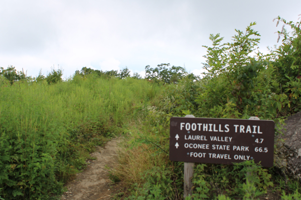
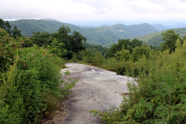
Below: A view
of the Foothills trail where Lee and Karen Duquette took a walk. |
 |
 |
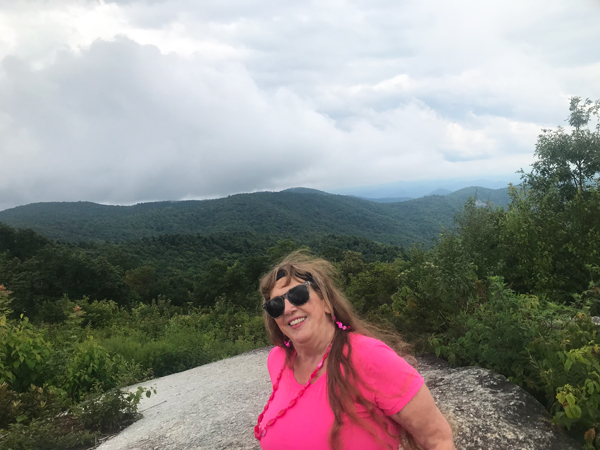
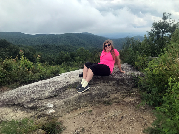
Below: Karen
Duquette on a big rock part way into the hiking path shown above. |
 |
 |
 |
 |
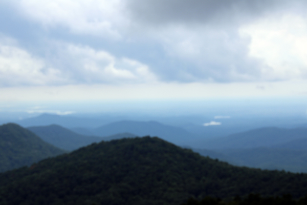
Below: View
from the Foothills Trail |
 |
 |
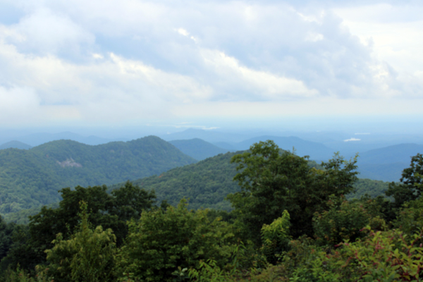 |
Below: Views
of the tower as taken from the Foothills Trail |
 |
 |