Lee
and Karen Duquette,
The Two RV Gypsies: Full-Time RVers
at Itasca State Park and the Mississippi Headwaters
July 1, 2013 |
|
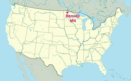
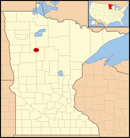
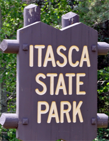
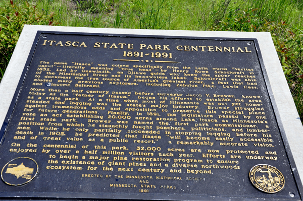
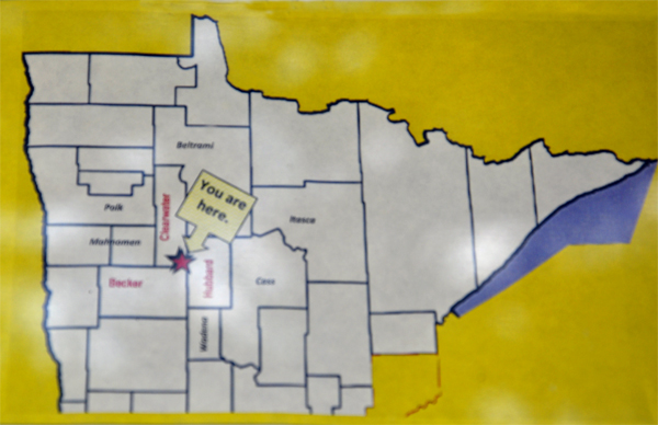
Itasca State Park is a state park in Minnesota, United States, and contains the headwaters of the Mississippi River. The park spans 32,690 acres of northern Minnesota, and is located about 21 miles north of Park Rapids, Minnesota and 25 miles from Bagley, Minnesota. The park is part of Minnesota's Pine Moraines and Outwash Plains Ecological Subsection and is contained within Clearwater, Hubbard, and Becker counties.
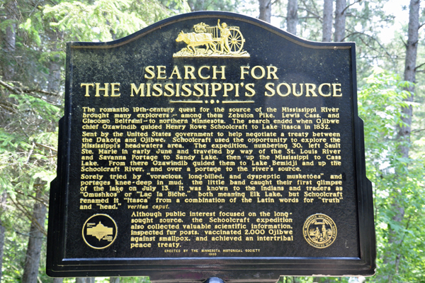
Itasca State Park was established by the Minnesota Legislature on April 20, 1891, making it the first of Minnesota's state parks and second oldest in the United States, behind Niagara Falls State Park. Henry Schoolcraft determined Lake Itasca as the river's source in 1832. It was named as a National Natural Landmark in 1965, and was added to the National Register of Historic Places in 1973. About 500,000 people visit Itasca State Park annually. This is a fee area. |
|
|
|
|
|
|
|
|
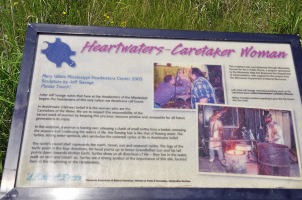
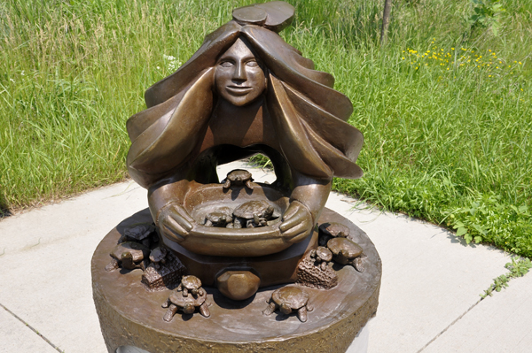
To the historic Ojibwe Indians,
the river was known as "Gichiziibi - The Great River."
The name "Mississippi" has its origins from with
the Algonquian Indian language family. The Mississippi ("Misizibi")
refers to a river spread over a large area. |
|
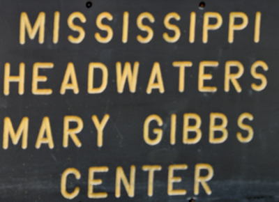
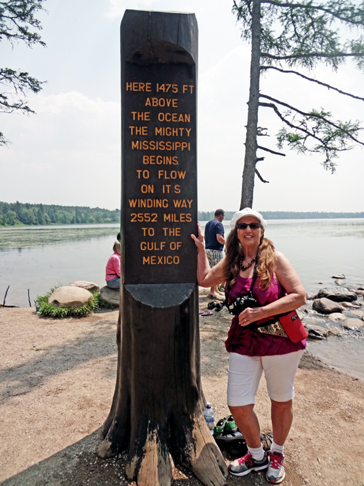
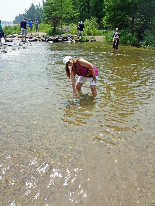
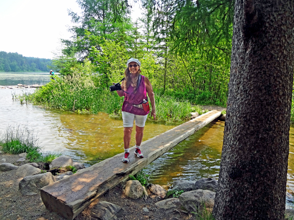
Below: Karen Duquette at the Headwaters
for the Mississippi River - where it begins. |
|
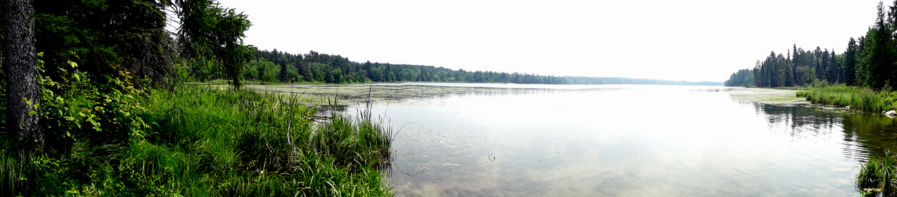
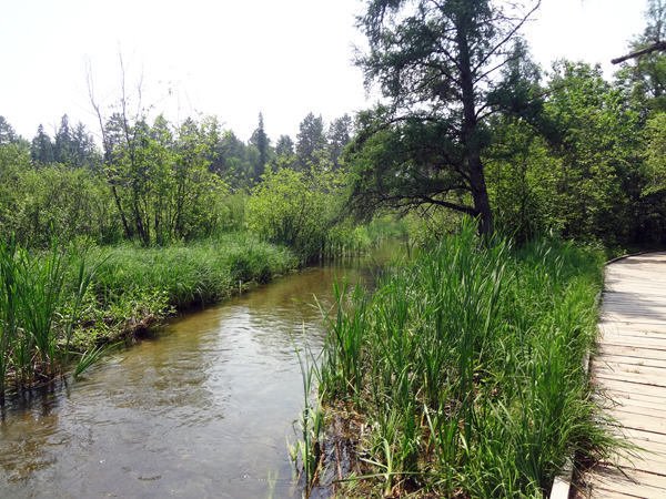
Below: Lake Itasca, the official
source of the Mississippi River and a scenic area of northern Minnesota,
has remained relatively unchanged from its natural state. Most of the
area has a heavy growth of timber that includes virgin red pine, which
is also Minnesota's state tree. Some of the red pine in Itasca are over
200 years old. |
|
|
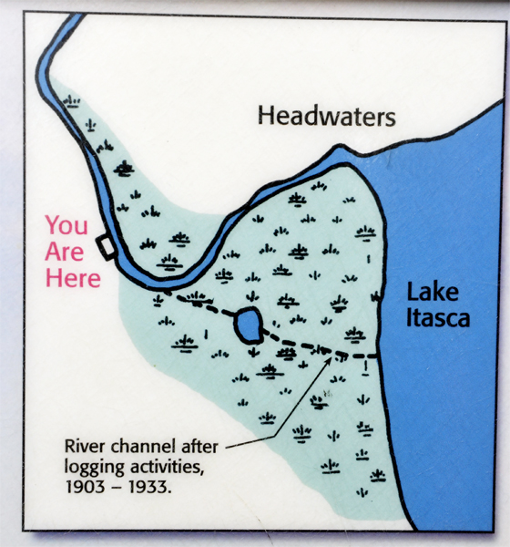
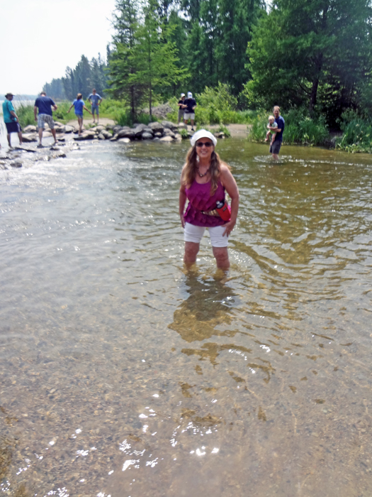
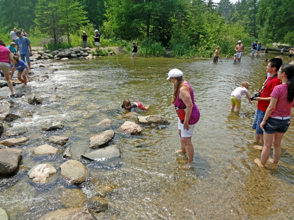
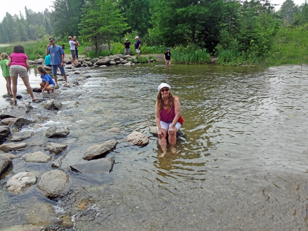
Below: Karen Duquette walked
across The Mississippi River where it begins its 2,552-mile journey
to the Gulf of Mexico here. At the outflow from Lake Itasca, millions
of visitors have walked across the headwaters, wading in the footsteps
of American history. |
|
|
|
|
|
|
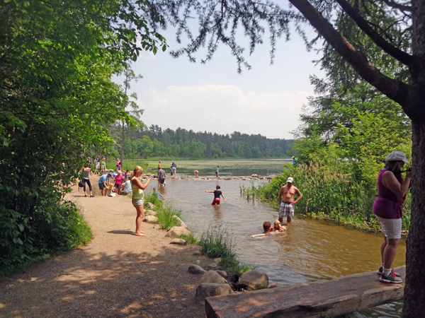
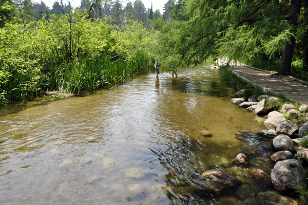
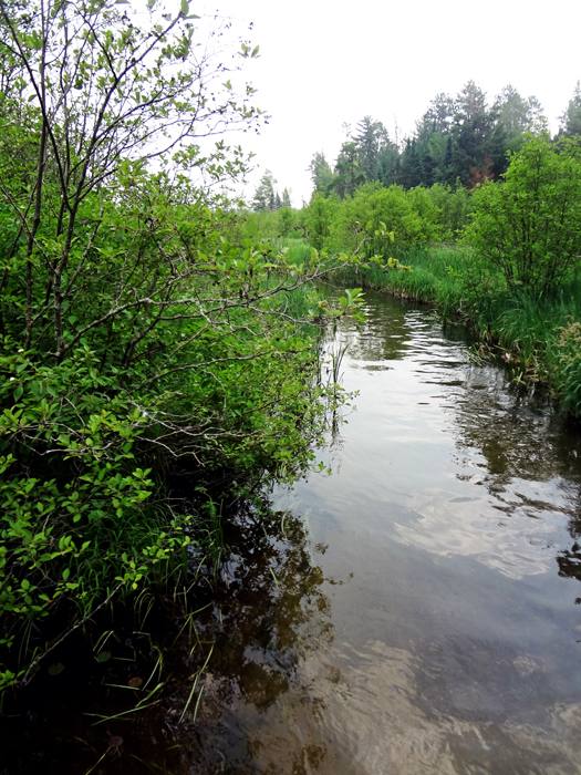
Below: A view of the Mississippi River as it starts its flow towards
the Gulf of Mexico.
|
|
|
|
|
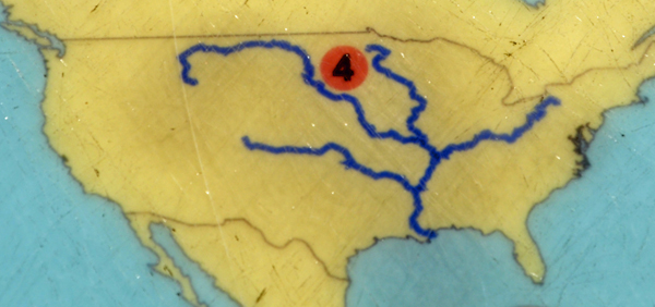
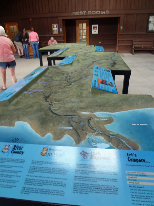
Below: A very large map
showing the route of the Mississippi River |
|
THIS DOES NOT HAVE TO BE A LINEAR PAGE, SO THERE ARE SEVERAL TRAVEL
OPTIONS BELOW. PLEASE CHOOSE CAREFULLY |
NOTE FYI: In 2014, Lee and Karen Duquette went to Mud
Island in Memphis, Tennessee because The River Walk is one of the most
unique representations of the Mississippi River in the world - a winding
1,000 mile journey of the Lower Mississippi reproduced in a one-half
mile concrete sculpture. Here is the link for that BUT be sure to return
here to finish the 2013 journey -
Lower Mississippi River reproduced in a 1/2 mile concrete sculpture
in TN.
The two RV Gypsies also returned to Itasca
State Park in 2015 and Karen and Lee Duquette walked in the Mississippi
River from the Headwaters to the first foot bridge. So a portion of
this page was combined with the 2015 page to give viewers a more complete
overview of this amazing place. |
OR STAY IN THE YEAR 2013 AND use the menu below or
the main navigational buttons. |

 AFTER
you have seen all three sections above, please continue on to the
adventures of the two RV Gypsies in
AFTER
you have seen all three sections above, please continue on to the
adventures of the two RV Gypsies in 


