 |
|
|
 |
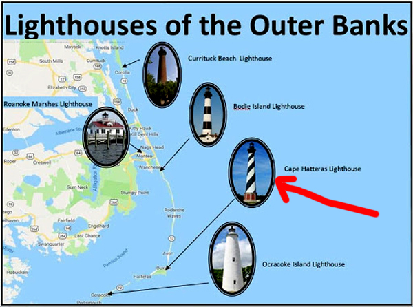
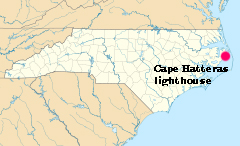
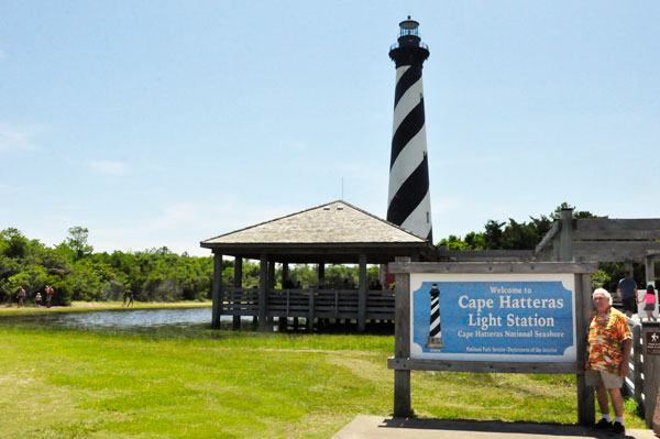
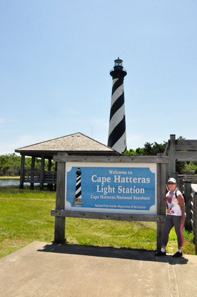
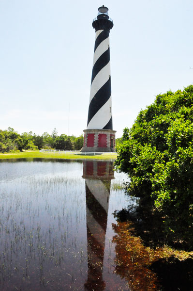
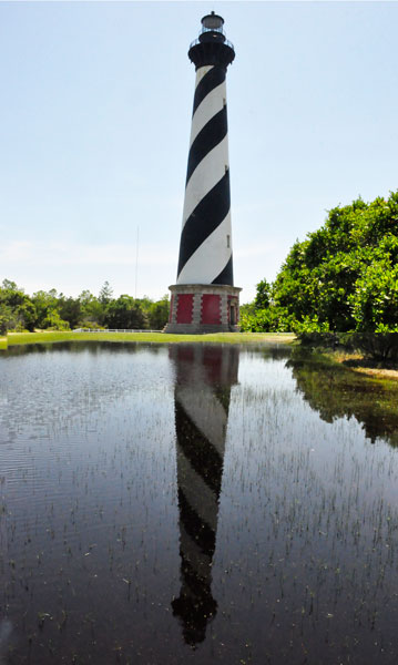
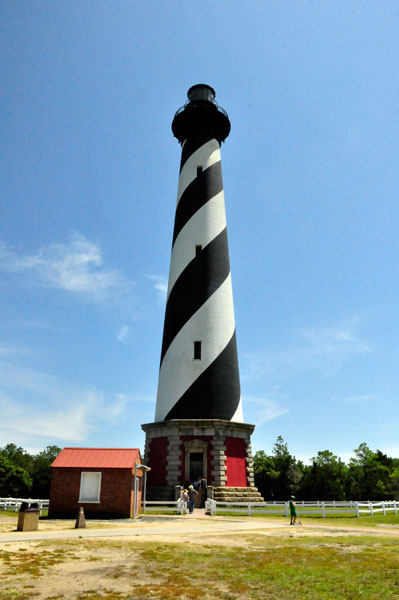
Cape Hatteras Light is a lighthouse located on Hatteras Island in the Outer Banks in the town of Buxton, North Carolina and is part of the Cape Hatteras National Seashore. The Outer Banks are a group of barrier islands on the North Carolina coast that separate the Atlantic Ocean from the coastal sounds and inlets.
Atlantic currents in this area made for excellent travel for ships, except in the area of Diamond Shoals, just offshore at Cape Hatteras. Nearby, the warm Gulf Stream ocean current collides with the colder Labrador Current, creating ideal conditions for powerful ocean storms and sea swells. The large number of ships that ran aground because of these shifting sandbars gave this area the nickname "Graveyard of the Atlantic."
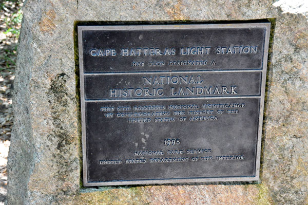
It also led Congress to authorize the construction of the Cape Hatteras Light. Its 210-foot height makes it the tallest brick bottom lighthouse structure in the United States and 2nd in the world. Since its base is almost at sea level, it is only the 15th highest light in the United States, the first 14 being built on higher ground. |
 |
 |
 Original Lighthouse: On July 10, 1794, Congress appropriated $44,000 "for erecting a lighthouse on the headland of Cape Hatteras and a lighted beacon on Shell Castle Island, in the harbor of Ocracoke in the State of North Carolina." The Cape Hatteras Lighthouse was constructed in 1802. Original Lighthouse: On July 10, 1794, Congress appropriated $44,000 "for erecting a lighthouse on the headland of Cape Hatteras and a lighted beacon on Shell Castle Island, in the harbor of Ocracoke in the State of North Carolina." The Cape Hatteras Lighthouse was constructed in 1802.
The Cape Hatteras light marked very dangerous shoals that extend from the cape for a distance of 10 nautical miles. The original tower was built of dark sandstone and retained its natural color. The original light consisted of 18 lamps; with 14-inch reflectors, and was 112 feet above sea level. It was visible in clear weather for a distance of 18 miles.
The improvement in the light began in 1845 when the reflectors were changed from 14 to 15-inch ). In 1848 the 18 lamps were changed to 15 lamps with 21-inch reflectors and the light had become visible in clear weather at a distance of 20 miles. In 1854 a first-order Fresnel lens with flashing white light was substituted for the old reflecting apparatus, and the tower was raised to 150 feet.
In 1860 the Lighthouse Board reported that Cape Hatteras Lighthouse required protection, due to the outbreak of the Civil War. In 1862 the Board reported "Cape Hatteras, lens and lantern destroyed, light re-exhibited.
|
 |
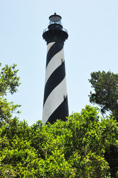 |
Second Lighthouse: At the behest of mariners and officers of the U.S. Navy, Congress appropriated $80,000 to the United States Lighthouse Board to construct a new beacon at Cape Hatteras in 1868. Completed in just under two years, it was the tallest brick lighthouse tower in the world. It was 200 feet above ground and the focal height of the light was 208 feet above water. The old tower was demolished in February 1871, leaving ruins that lasted until finally eroded away in a storm in 1980. The new light consisted of a 36-inch aviation-type rotating beacon of 250,000 candlepower, visible 20 miles, and flashing white every 7.5 seconds. The steel skeleton tower, was retained by the Coast Guard in the event that the brick tower again became endangered by erosion requiring that the light again be moved. |
 |
 |
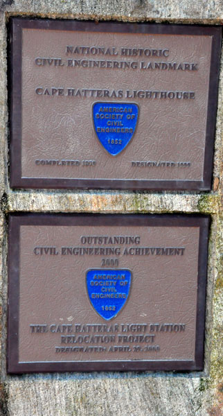
Relocation: In 1999, with the sea again encroaching, the Cape Hatteras lighthouse had to be moved from its original location at the edge of the ocean to safer ground. Due to erosion of the shore, the lighthouse was just 15 feet from the water's edge and was in imminent danger. The move was a total distance of 2,900 feet to the southwest, placing the lighthouse 1,500 feet from the current shoreline. All other support buildings at the site were also moved at the same time. All support buildings were placed back in positions that maintained their original compass orientations and distance/height relationship to the lighthouse. The move was controversial at the time with speculation that the structure would not survive the move, resulting in lawsuits that were later dismissed. The move was completed on September 14, 1999.
The Cape Hatteras Lighthouse is one of the tallest masonry structures ever moved (200 feet tall and weighing 5,000 tons). |
 |
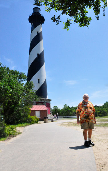 |
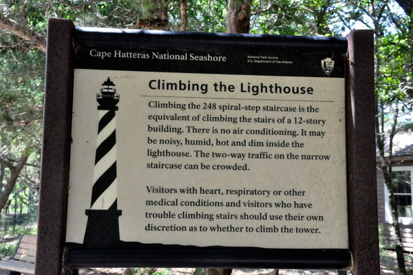
Due to the Corona Virus, the lighthouse could NOT be entered or climbed on the date that the Two RV Gypsies were here. The Two RV Gypsies wore their mask whenever they were around people, but took the masks off for photos. |
 |
 |
 |
| Above quotes From
Wikipedia, the free encyclopedia and
https://en.wikipedia.org/wiki/Cape_Hatteras_Lighthouse |