|
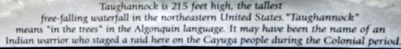
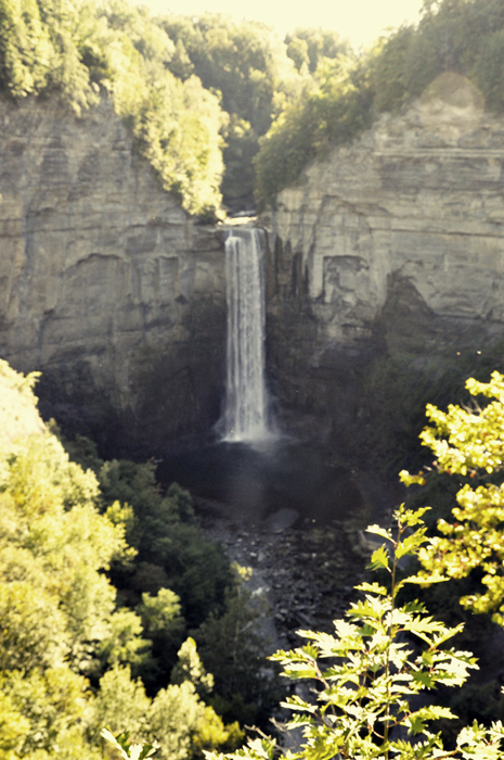
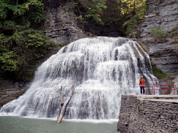
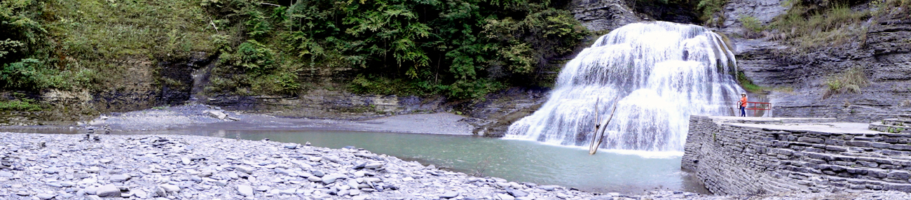
Taughannock Falls is the highest cascading waterfall east of the Rocky Mountains. It is located just south of Trumansburg by the shore of Cayuga Lake. |
|
|
| |
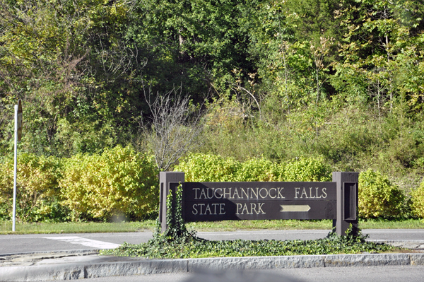
 Taughannock Falls State Park is located in the Town of Ulysses in Tompkins County, New York. The park is northwest of Ithaca. The name Taughannock comes from the Algonquian-speaking Lenni Lenape (Delaware) Indians, referring either to chief Taughannock or the word taghkanic (great fall in the woods). Taughannock Falls State Park is located in the Town of Ulysses in Tompkins County, New York. The park is northwest of Ithaca. The name Taughannock comes from the Algonquian-speaking Lenni Lenape (Delaware) Indians, referring either to chief Taughannock or the word taghkanic (great fall in the woods).
The main cataract of the falls is a 215-foot drop, making it 33 feet taller than Niagara Falls. It is the tallest single-drop waterfall east of the Rocky Mountains. The water flows through a long gorge with cliffs up to 400 feet high. The waterfall and gorge comprise an example of a hanging valley that developed in a very similar fashion to the one at nearby Watkins Glen State Park (which is shown on the next page of this website). None of the local gorges were carved by glaciers. In fact all of the gorges are post-glacial valleys carved by the streams that still run through them. It is the valleys over which the waterfalls hang that were eroded (over-deepened) by the advance of the Pleistocene ice sheets.
(Above quote from Wikipedia, the free encyclopedia - as are many other quotes on this website) |
|
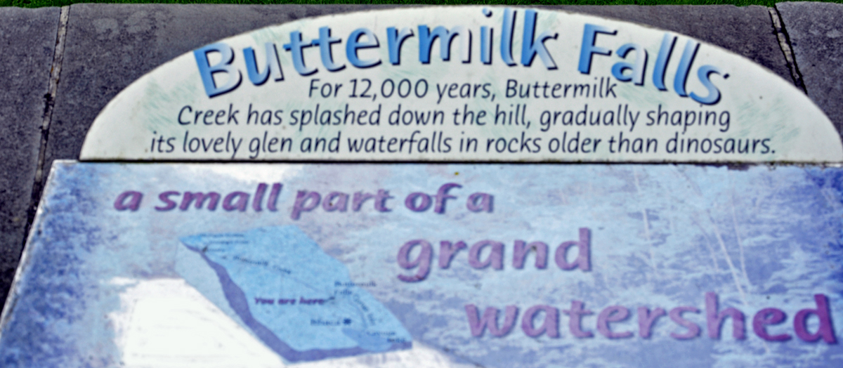
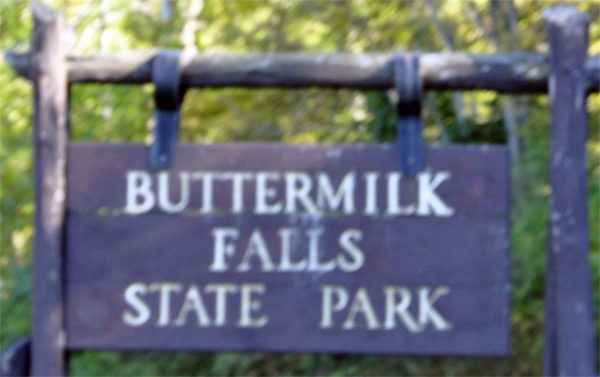
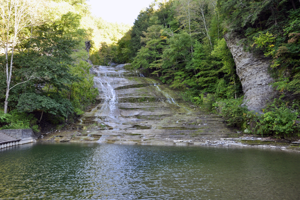
Buttermilk Falls is a high, multi-cascading waterfall located south of Ithaca, in Buttermilk Falls State Park, near Robert H. Treman State Park. The photo below is only the lower portion of Buttermilk Falls.
|
|
|
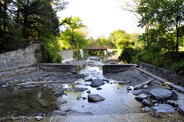
Standing on the low bridge that is just below the lower portion of Buttermilk Falls and looking away from the falls. |
|
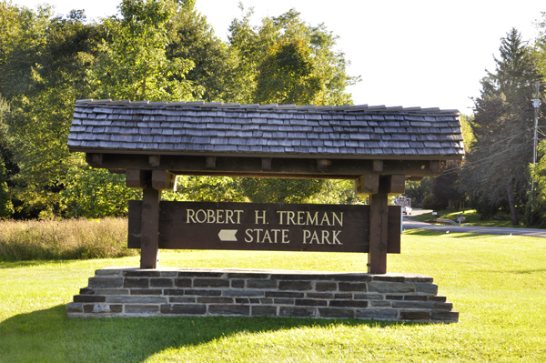
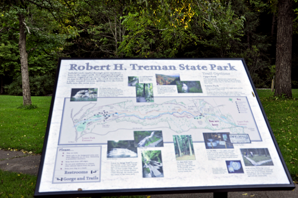
Below: At Robert Treman State Park, the Lower Falls forms a natural swimming hole. (Although the two RV Gypsies would not like to swim here after seeing how uneven the bottom is and the big rocks that would be under a swimmer.) The park is located a few miles south of Ithaca. Below are photos of the Lower Falls, which means there must be Upper Falls, but the two RV Gypsies did not figure out how to get there, and later learned the Upper trail was closed. Look how small Karen Duquette is when she stands near the waterfall. |
|
|
|
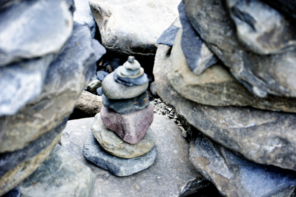
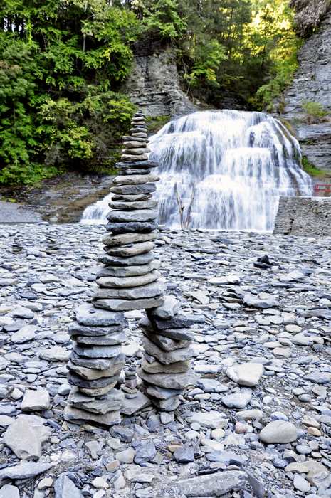
Since the water level was
low and the rocks were showing, somebody built an Inukshuk - a figure
made of stacked stones (usually in human-like shape - but not this time).
The Inuit used Inukshuk as a marker to find their way when traveling.
Notice the small centerpiece of this stone figure which even has a tiny
pebble on top. Nice workmanship from whoever built this. |
|
 |
| |
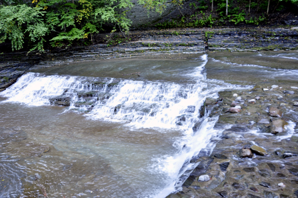
Looking away from the Lower Falls |
|
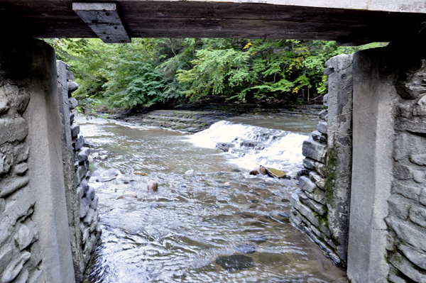
Looking under the bridge shown above to see another small waterfall |
|
|
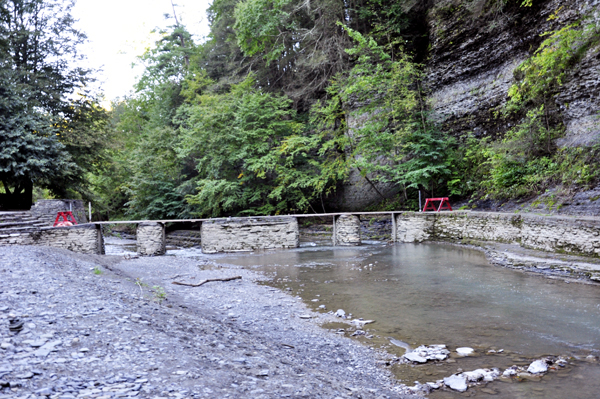
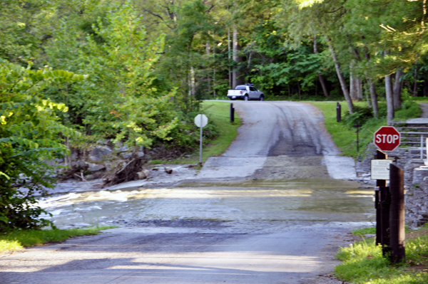
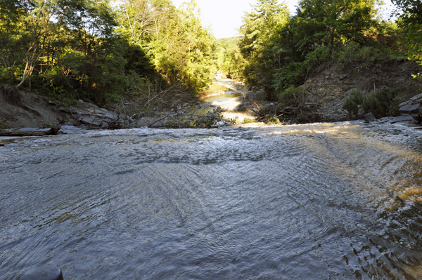
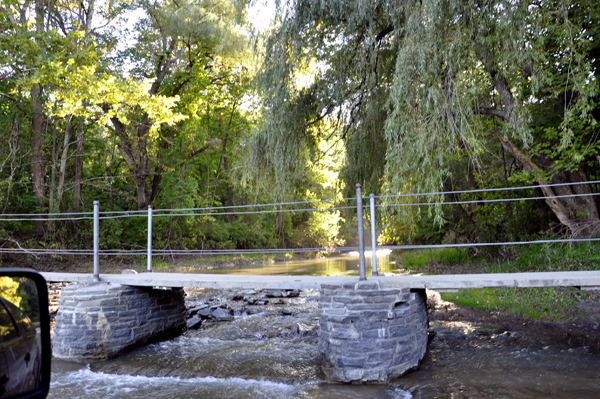
The two RV Gypsies walked back to the parking lot. The water from the falls runs right over the road and Lee Duquette drove through the water to get to the other side. |
|
|
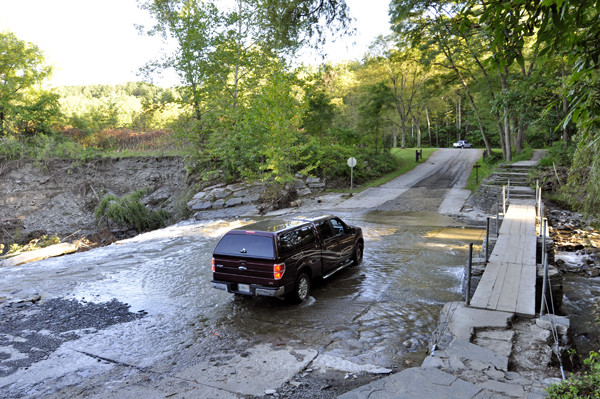
Karen Duquette took a photo out of each side of the car window as Lee drove over the flowing water on the road. |
|
|
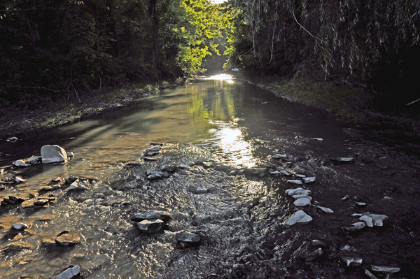
Then Karen Duquette stood on the bridge shown in the above photo and took a photo looking back up towards the Lower Falls, which of course was too far upstream to be seen from here. |
|
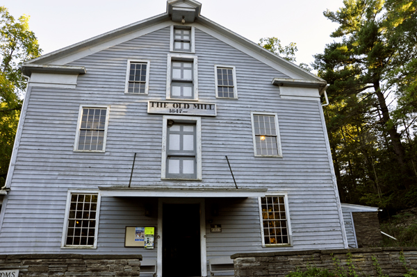
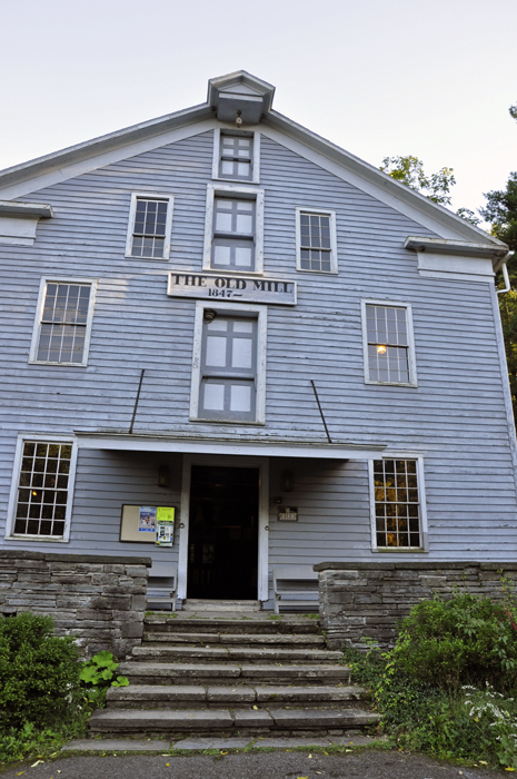
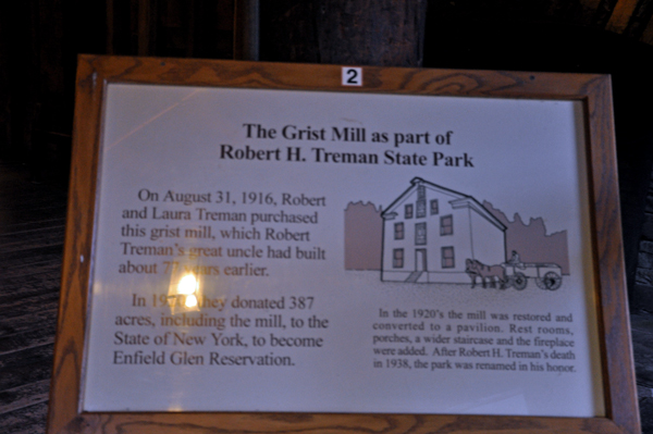
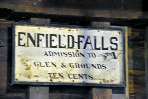
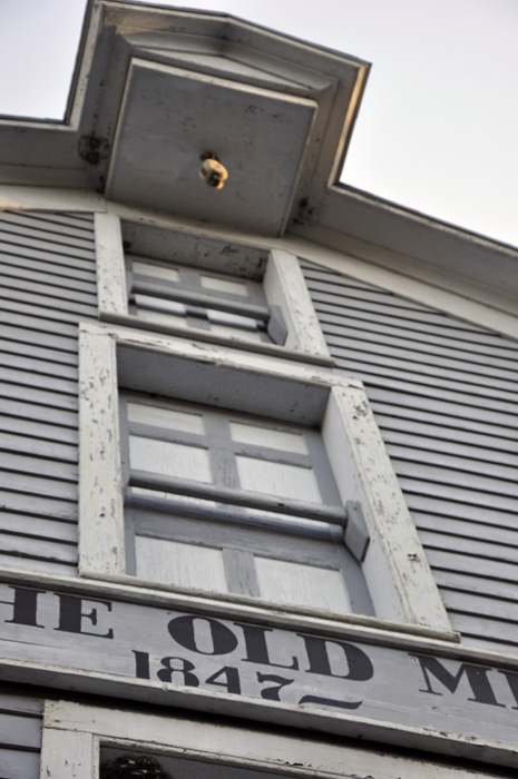
Below: Another area of Robert H Treman State Park led the two RV Gypsies to an old Grist Mill, with Enfield Falls behind the Grist Mill. Actually, a village lies buried beneath this State Park. Only the gristmill (the Old Mill) and the Miller's House remain of a once-vibrant hamlet in the 1800s. However, remnants of the settlement, including homes and two cemeteries still exist beyond the boundary of the park. |
|
|
|
 |
| |
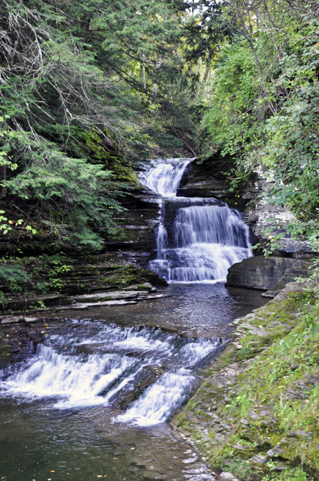
Behind the Old Mill (Grist Mill), the two RV Gypsies enjoyed a view of Enfield Falls and Enfield Creek. The water from this creek powered the Old Mill's waterwheel. |
|
|
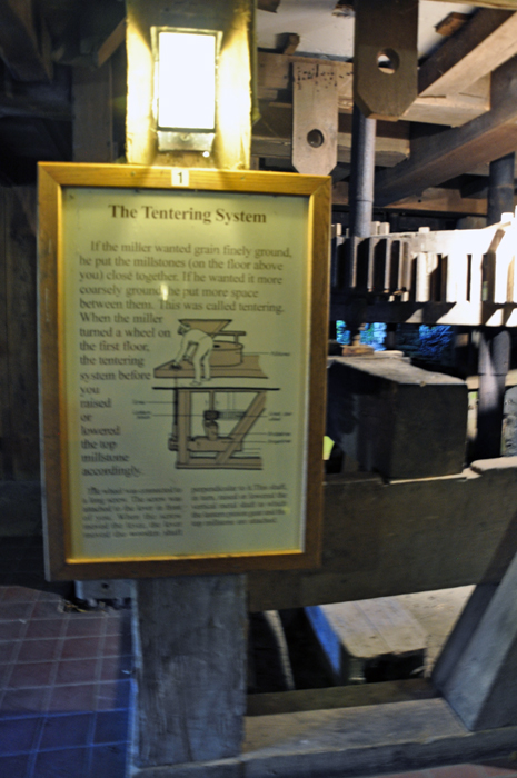
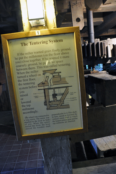
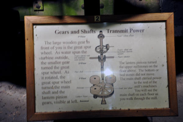
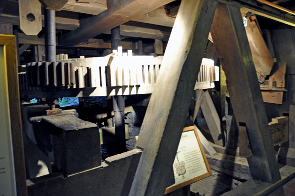
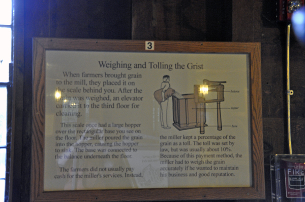
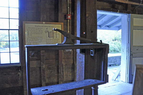
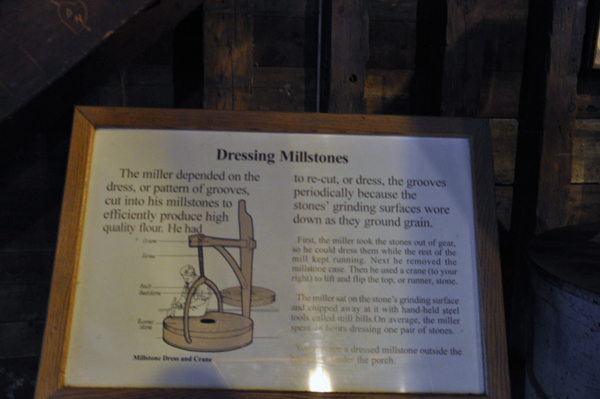
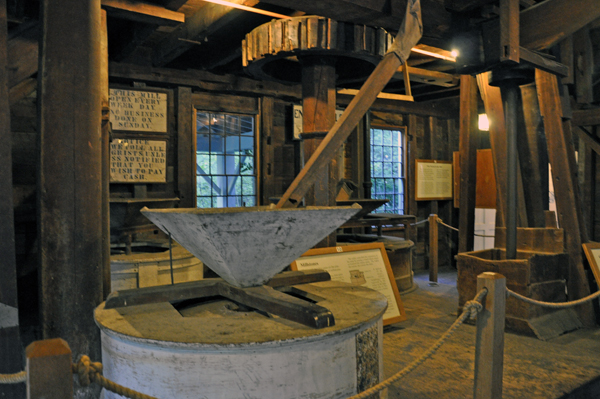
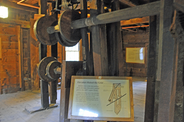
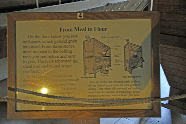
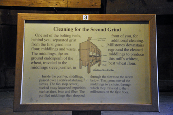
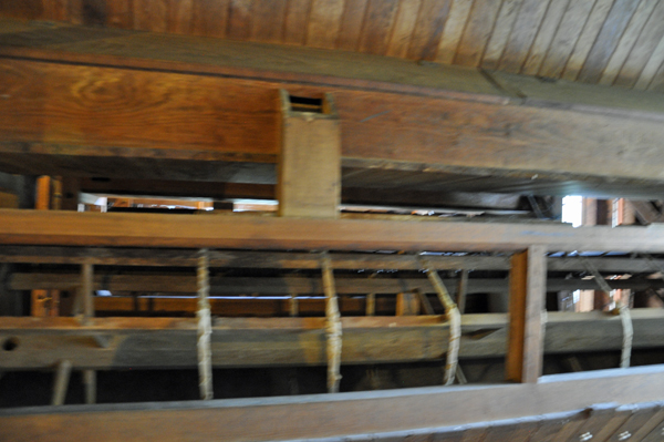
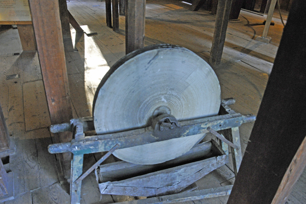
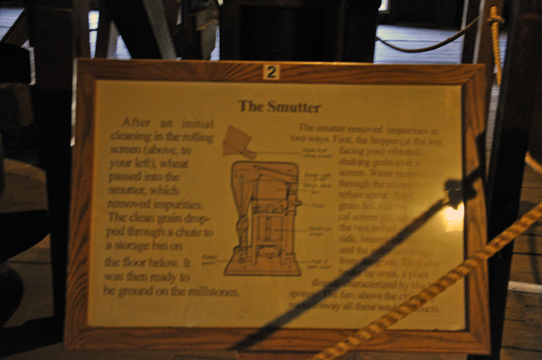
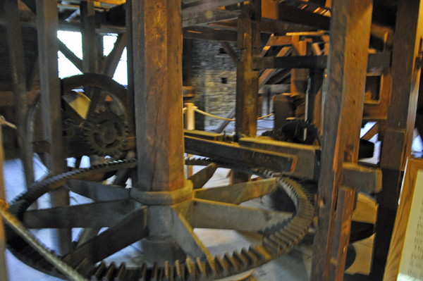
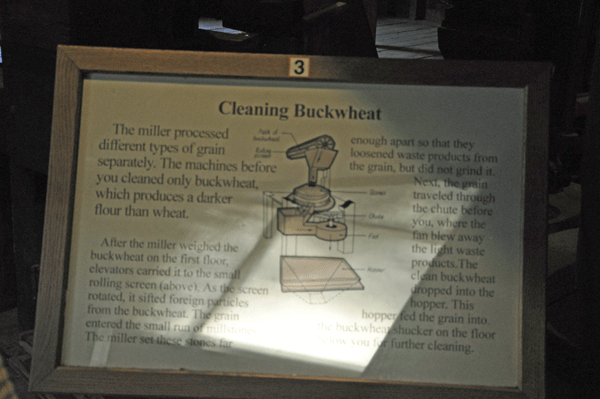
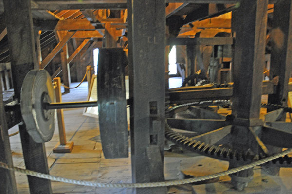
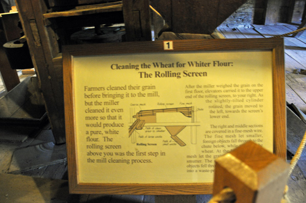
The two RV Gypsies entered
the Grist Mill, a 4-story building. The second and third floors contained
some of the machinery that was used when it was a functioning gristmill
between 1839 and 1916. In the basement there were displays that illustrate
the Big Mill Wheel and how the water was channeled to power to gristmill. |
|
|
|
|
|
|
|
|
|
|
|
|
|
|
|
|
|
|
|
|
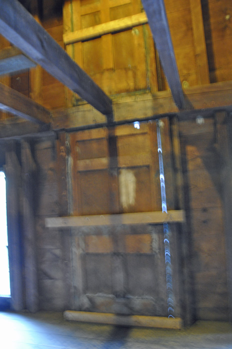
The two RV Gypsies wondered about how they got everything up into the 4th floor. Below are photos of the doors (taken from both inside the building and outside the building). There was a pulley-system to these doors when the gristmill was in operation. Notice the big beehive on the outside of the building. Yes, the bees were actively around the beehive when the below photo was taken. |
|
|
|
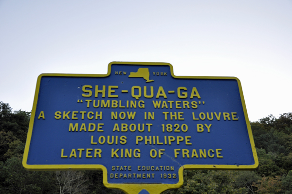
Montour Falls is a village in Schuyler County, New York. A waterfall in the village gives the village its name. The name "Montour" was derived from Queen Catharine Montour of the Senecas.
The Village of Montour Falls is mostly within the Town of Montour, but a small part is within the Town of Dix. The village is north of Elmira, New York. |
|
|
| |
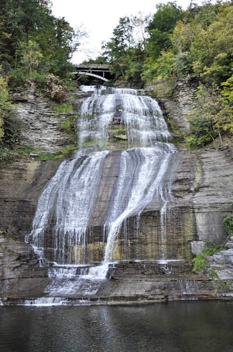
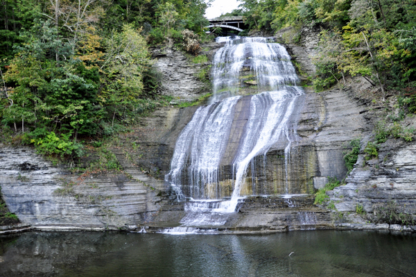
After driving a short distance, the two RV Gypsies came to a little park in the town of Montour with a 30-minute parking space big enough for maybe two small cars. A two-minute walk brought the two RV Gypsies to a railing, and the above view of the She-Qua-Ca Falls (Montour Falls). The water at the bottom of the falls only flows to the left as shown in the photo below. But look: there is a bridge at the top of the falls. |
|
|
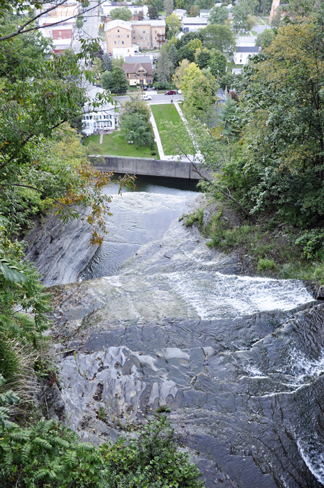
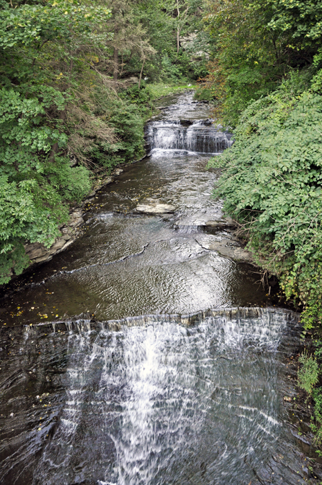
Then the two RV Gypsies decided to drive to the bridge seen at the top of the falls. A few minutes later, the two RV Gypsies stood on the bridge at the top of the falls and got a look at the park they were just in plus a glimpse of the town of Montour. Karen Duquette also took a photo of the falls looking straight down from the bridge and admired the beauty of several tiers in the cascade of water. |
|
|
 AFTER
you have seen all three sites above, please continue on to see
AFTER
you have seen all three sites above, please continue on to see


