The
Two RV Gypsies: Full-Time RVers
at Dawson Creek, British Columbia, Canada
The Beginning of The Alaska
Highway
June 11, 2016 (plus some photos from 2009)
| The
Two RV Gypsies: Full-Time RVers
|
|
 |
|
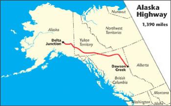
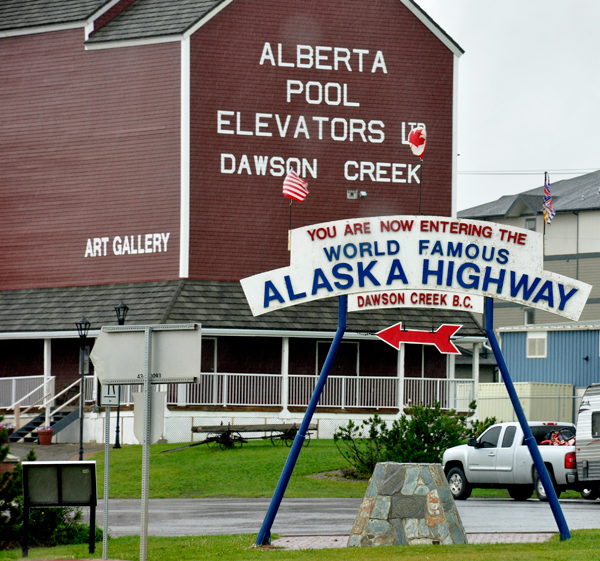
The Alaska Highway begins at Mile 0 in Dawson Creek, BC. The first 613 miles of the Alaska Highway are in British Columbia, where it is designated BC Highway 97 North. The highway travels in a northwesterly direction to the Yukon border near Watson Lake, YT (Historical Mile 635). From there it continues as Yukon Highway 1, crossing 577 miles of Yukon to Port Alcan on the Alaska border. The Alaska Highway crosses into Alaska at Historical Mile 1221.8, where it becomes Alaska Route 2. From this international border, it is 200 miles to Delta Junction, AK (Historical Mile 1422), the official end of the Alaska Highway, and 298 miles to Fairbanks, the unofficial end of the highway, at Historical Mile 1520. |
|
 |
|
 |
|
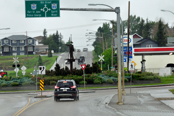
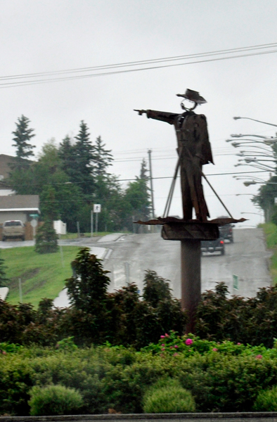
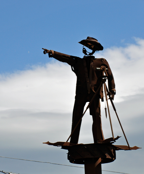
| Situated in the middle of the Traffic Circle (Connects Highway 2, Highway 49 or Highway 97, along 8th street) stands the Pioneer Surveyor Statue. It is a tribute to the thousands of men who built the Alaska Highway. The figure points northwest, the direction the soldiers took in the 1940's. The statue is made of scrap metal found in the area - a scrap iron sculpture pointing the way to Alaska. Surveyors were the first stage of the road, setting out the path for construction crews. The statue's garments and equipment are authentic to the 40's era. The statue was created by local sculpture, Karl Mattson. | |
 |
|
 |
 |
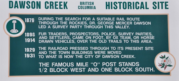
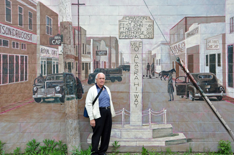
Below: The Mile 0 Cairn marks the beginning of the Alaska Highway and is located on the very spot the military surveyors placed their transit as they plotted the route the highway would take. All mileage along the Alaska Highway route is measured from this very spot. |
|
Below: Karen Duquette 2009 |
Below: 2016 photo |
 |
 |
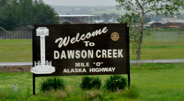
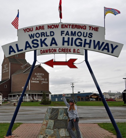
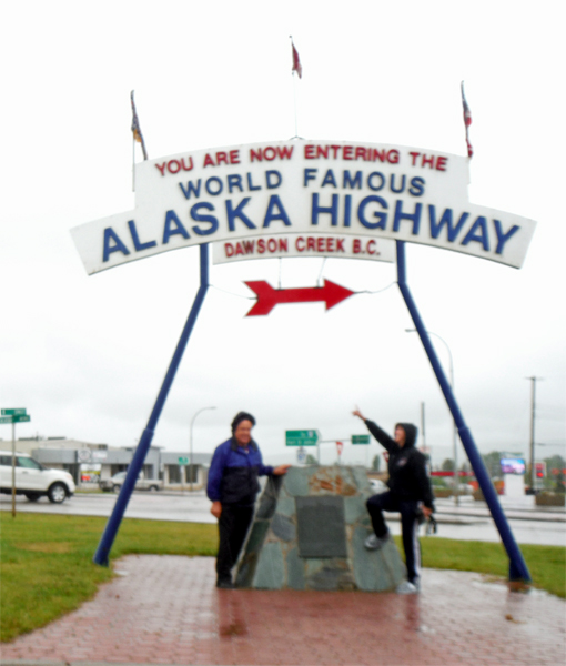
Below: The Two RV Gypsies at the entry to the Alaska Highway on June 11, 2016 - a rainy day |
|
 |
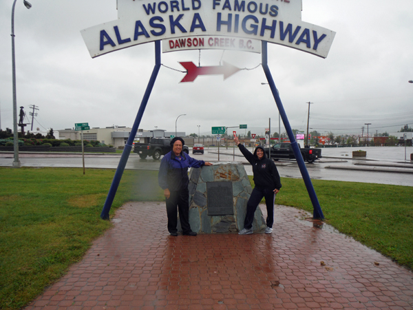 |
Below: Karen Duquette at the entry to the Alaska Highway on June 12, 2016 - better weather than yesterday. |
|
 |
|
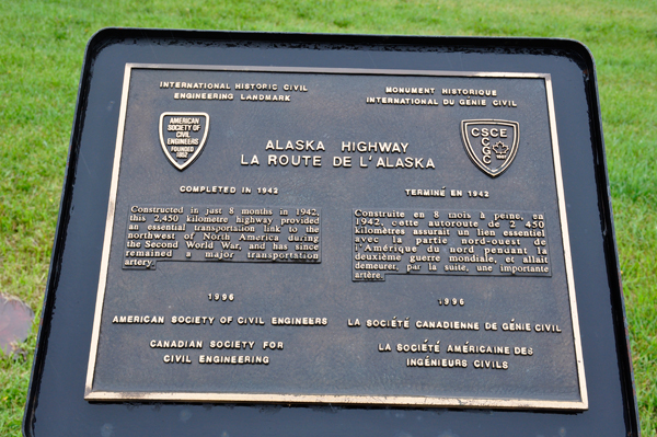
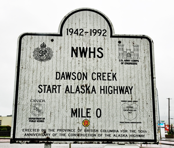
Below: the plaque on the sign shown above and another nearby sign. |
|
 |
 |
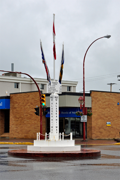
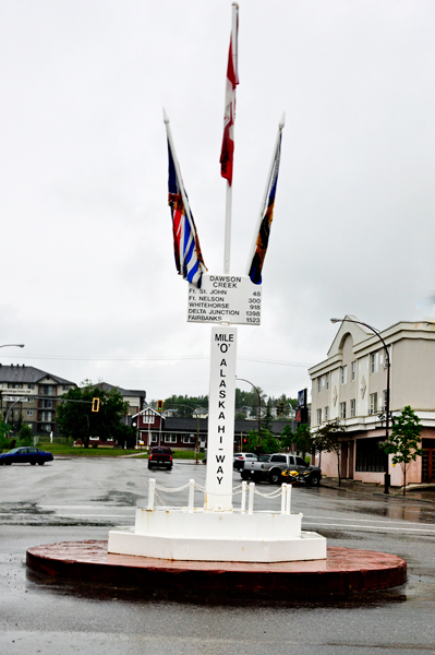
Mile 0 Post (1946): Designated by local artist, Ellis Gislasson for the Jaycees Junior Chamber of Commerce. The Mile 0 Post has become one of the most photographed markers on the Alaska Highway. There have been three Mile 0 Posts over the years with the first wooden Mile 0 Post being destroyed by a drunk driver, and the second was stolen by Halloween pranksters and replaced with an outhouse. This post was installed in the 1980s and is metal and is bolted into place. It flies the flags of Canada, the province of British Columbia, and the community of Dawson Creek. |
|
 |
 |
 |
|
|
|
 |
 |
 |
|
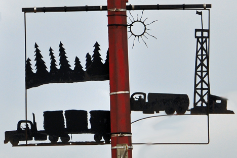
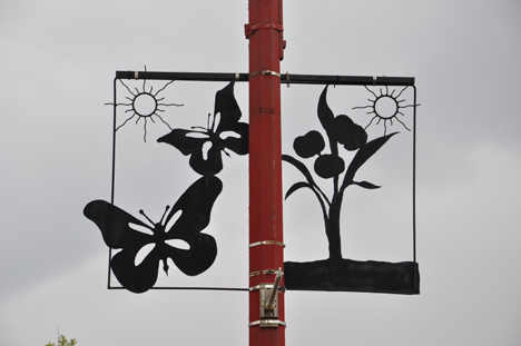
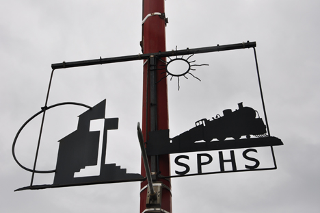
SIGNS ON LIGHTPOLES IN
DAWSON CREEK (2009) photos |
|
 |
 |
 |
 |
 Explosion block - Supper time February 13, 1943, a fire ignited 60 cases
of dynamite causing an explosion that rocked the area, destroyed the block
and shattered most of the windows in town. Five confirmed deaths, hundreds
of injuries, and a loss of $350,000 (1940 wartime dollars) for the buildings
destroyed.
Explosion block - Supper time February 13, 1943, a fire ignited 60 cases
of dynamite causing an explosion that rocked the area, destroyed the block
and shattered most of the windows in town. Five confirmed deaths, hundreds
of injuries, and a loss of $350,000 (1940 wartime dollars) for the buildings
destroyed. |
|
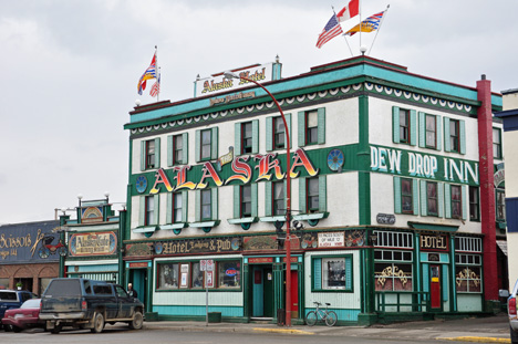 |
When the Alaska
Hotel (Dew Drop Inn) was built in 1933, it was a 6-room hotel with a lobby
and cafe. In 1942, the Inn became licensed to sell alcohol. The 1940's
beer parlor was so busy that lines stretched around the building and customers
were allowed in for a drink and then forced to go out to the end of the
line. Today it holds the distinction of being the same type of business
occupying the same building for the longest period. |
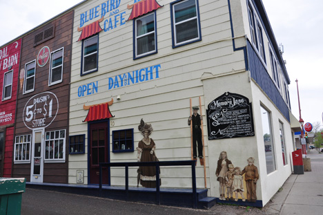
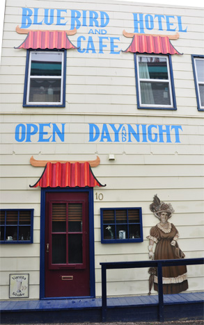
| Blue Bird Hotel was one of 3 hotels in town in 1934. It was reminiscent of the many small operations established by Chinese immigrants in prairie towns during the era of the west being opened up. The original building is still in use and is part of the Mile 0 Hotel | |
 |
 |
 |
|
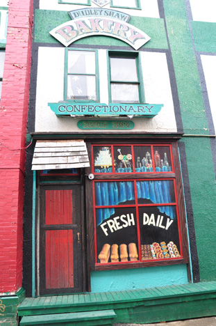
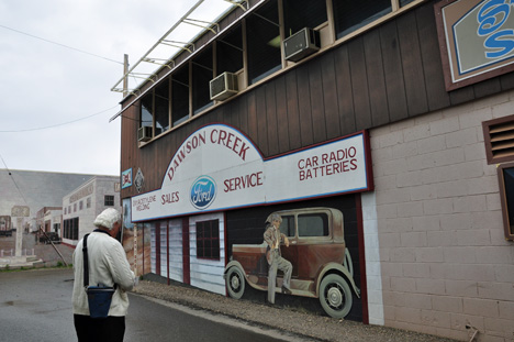
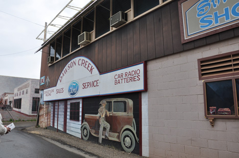
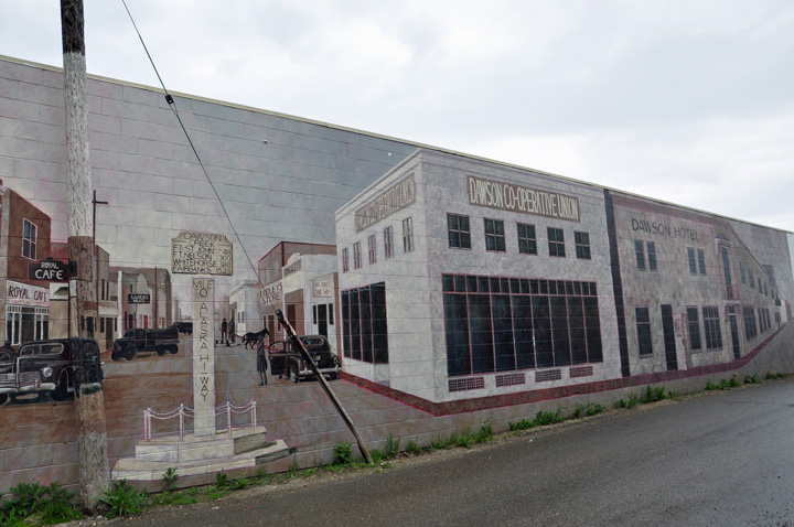
Murals on memory lane - wander back in time to the Dawson Creek of the 1930's and 1940's. Murals depict the story of Dawson Creek since the highway was completed in 1942. |
|
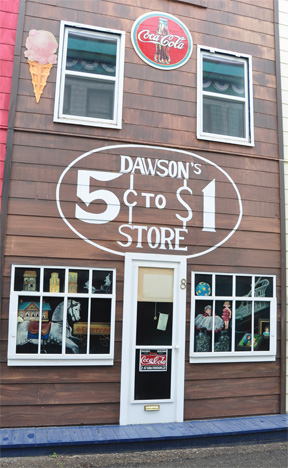 |
The 5¢ to $1 Store was established in the early 1930's and sold many varieties of dry goods. Shown in the window are gum balls and toys. In 1942, in preparation of the troops arriving, this building became the U.S. Army Quartermaster staff headquarters. |
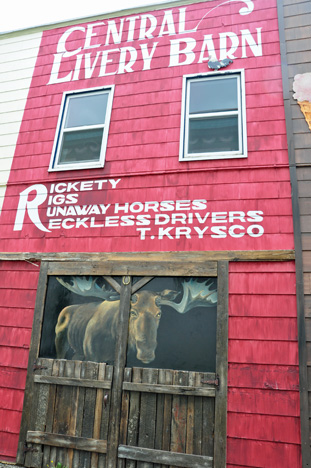
The mural
image of the moose depicted in the livery stable of the Central Livery
Barn below evolves from an event from 1930's Dawson Creek folk lore. It
caused a lot of excitement the day it wandered into town. The moose was
discovered in the livery stable where he was contentedly munching the
grain from the stable floor, and flirting with the mares. By mistake,
someone locked the critter in. After being set free that evening, the
moose casually wandered away. |
 |
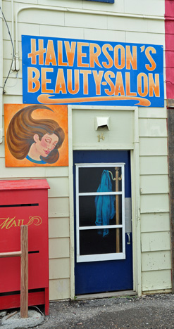 |
Halverson's Beauty Salon's original building still stands on its location at 925-103 Avenue and it is still a hairdressing shop. The outlet was established in 1945 by Anne Halverson and remained open for business until 1982. Anne was also well-known for her fabulous pioneer outfits that she wore during Bonanza Days (now Dawson Creek's Fall Fair & Rodeo) and other occasions. Because of her superb attire, someone nick-named her Bonanza Bonnie and it stuck. |
 |
 |
 |
 |
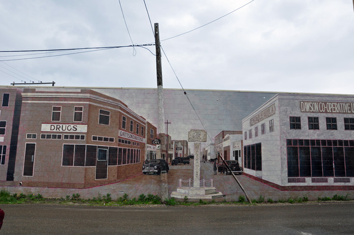
| At the end of the above alley is the main street of Dawson Creek as it was in 1946. Many of these original buildings (although renovated) are becoming permanent fixtures on Dawson Creek's downtown street scene. The Mile 0 Post of today is slightly different than the post shown here. The flags of the City of Dawson Creek, the Province of British Columbia and Canada have been fastened to the top of the post; and another Alaskan City, Delta Junction and its distance from Dawson Creek has been acknowledged. | |
 |
|
Note how neatly they painted
the pole and wire to match the mural. |
|
 |
|
 |
|
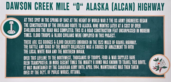
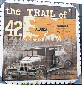
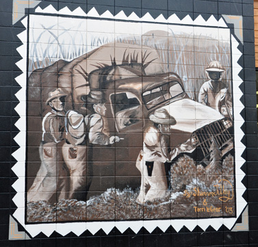
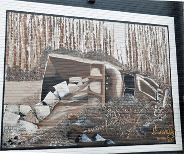
| These murals depict scenes of the construction of the Alaska Highway (1942) and show the formidable terrain that met the men and machines building the highway. After 8 months of construction, the road was officially opened on November 20, 1942 at Soldiers' Summit near Kluane Lake in the Yukon. The ceremony was called the Sharing of the Golden Scissors. Engraved gold scissors were used to cut a red, white and blue ribbon to open the road. Then the scissors were broken apart; one blade went to the American President and the other went to the Canadian Prime Minister. | |
 |
 |
 |
|
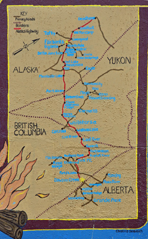 |
The mural map is part of the Alaska Highway Park Mural that is a pictorial view of life on the Alaskan Highway. The map is of the original route of the Alaska Highway that has some locations that no longer exist. |
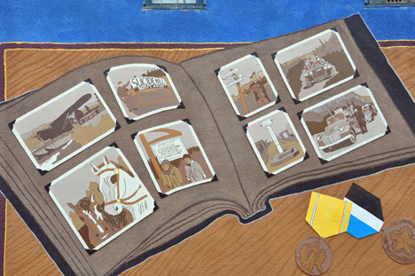
A mural giving a glimpse into some memorabilia of a soldier's life. |
 |
 |
|
 |
|||||||||||||||||||||||||||||||||||||||||||
This is not a linear site, so there are always options for where to navigate next. There are 3 choices below plus the main navigational buttons for this very large website |
|||||||||||||||||||||||||||||||||||||||||||
|
|||||||||||||||||||||||||||||||||||||||||||
OR |
|||||||||||||||||||||||||||||||||||||||||||
|
|||||||||||||||||||||||||||||||||||||||||||
OR |
|||||||||||||||||||||||||||||||||||||||||||
|
|||||||||||||||||||||||||||||||||||||||||||
| ||||||||||||||||||||||||||||||||||||||||||
 Continue
in the order of occurrence:
Continue
in the order of occurrence: