| Lee
and Karen Duquette, The Two RV Gypsies: Full-Time RVers on a covered bridge driving tour in Parke County, Indiana September 4-6, 2013 |
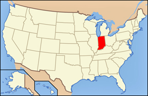 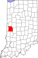 |
The covered bridges of Parke County Indiana touts itself as the "Covered Bridge Capital of the World". The county claims to have more covered bridges than any other county in the United States. This is due to the numerous streams and creeks in the county, and having the natural resources and designers to build the bridges. |
|
|
|
At one time, as many as 53 covered bridges existed (wholly or in part) in Parke County. Today, 31 of those bridges survive, 10 of which have been closed to vehicle traffic. The two RV Gypsies visited 13 of the 39 covered bridges. |
|
On December 22, 1978, all covered bridges still standing within the county were part of the Parke County Covered Bridges TR Multiple Property Submission, and went on the National Register of Historic Places. |
|
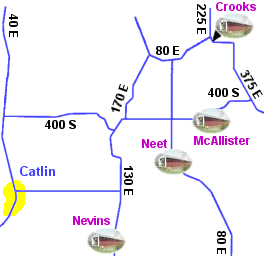
Tourists may view the historic bridges using five color-coded driving routes marked with roadside signs.Every year there is a covered bridge festival in October to celebrate the covered bridges in Indiana. In 2005 it was voted Big Secrets Local Finds by Travelocity. |
|
  |
 Most were built of poplar wood and built Burr Arch style. The main designers of the bridges were J.J. Daniels, J.A. Britton, William Hendricks, and Henry Wolf.
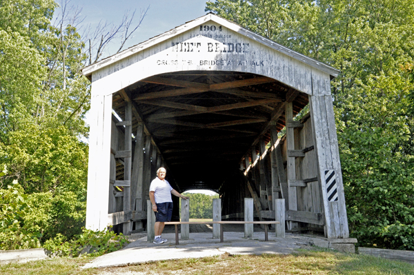
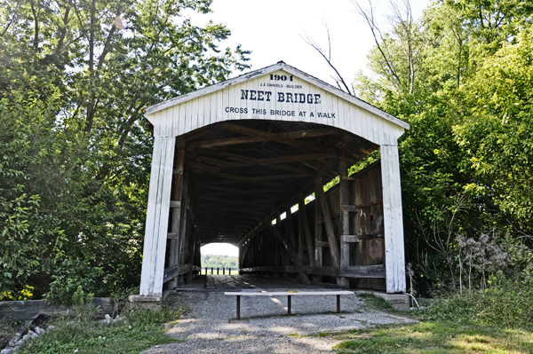
The Neet Covered Bridge crosses Little Raccoon Creek on County Road South 80 East in Parke County. This single span Burr Arch Truss structure has a length of 126 feet, or 144 feet including the 9-foot overhang at each end. It is 16 feet wide and 13 feet 6 inches high. Built in 1904 by Joseph J. Daniels, the road bypassed this structure in 1996. Though no historical marker is present, it was listed on the National Register of Historic Places in 1978. Neet Covered Bridge was accidentally omitted from the 1989 "World Guide to Covered Bridges," published by The National Society for the Preservation of Covered Bridges, Inc., but was listed in the 1972 release as #14-61-18. |
|
| above quote from http://www.countyhistory.com/coveredbridge/parke/neet.htm | |
 |
 |
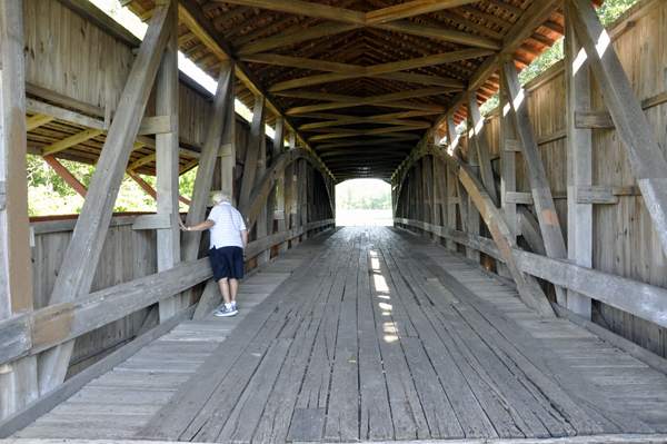
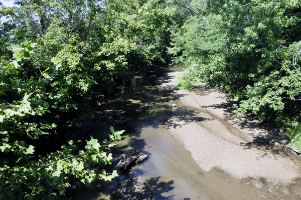
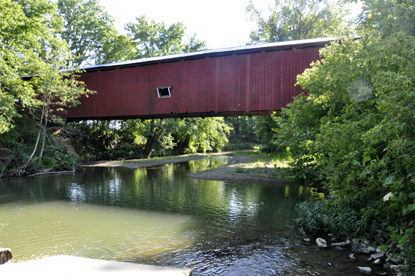
The two RV Gypsies walked through the Neet Covered Bridge and took a photo of Little Raccoon Creek from the one side of the bridge that had a window. This bridge is open only to pedestrian traffic. |
|
 |
 |
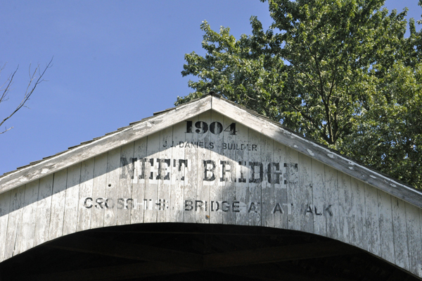
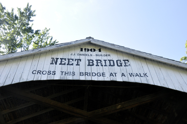
Below: The words on the Neet Bridge was more readable from this side of the bridge. |
|
 |
 |
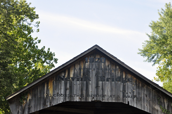
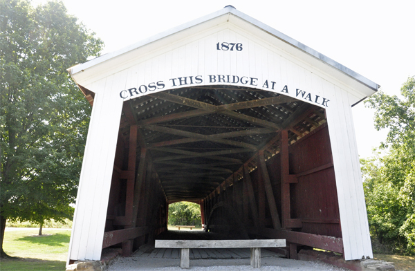
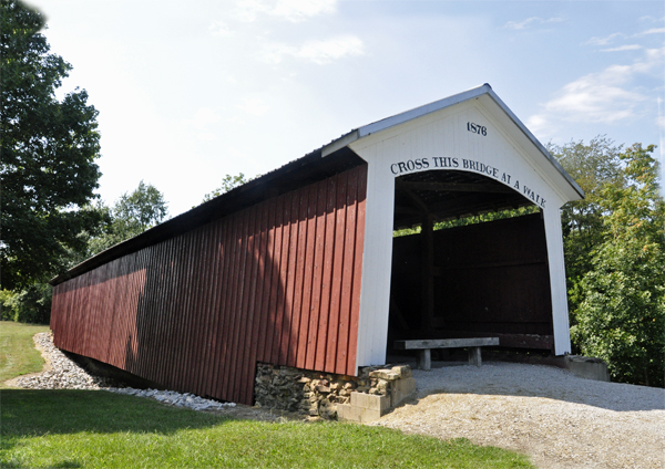
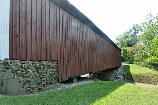
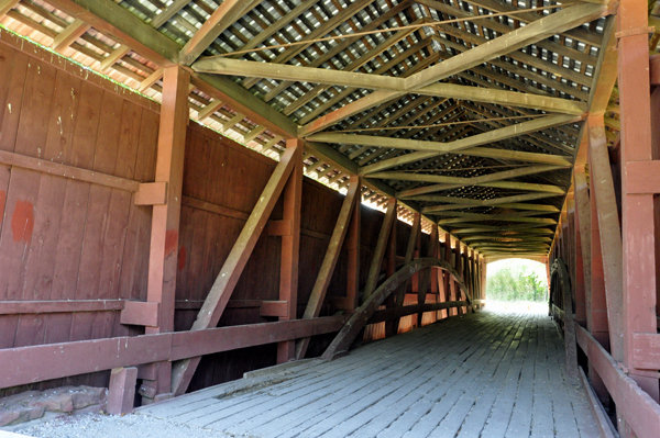
Nevins Covered Bridge crosses Little Raccoon Creek on County Road 130 East, just southeast of Catlin, in Section 4, Township 14 North, and Range 7 West, Parke County. This single span Burr Arch Truss structure has a length of 155 feet, or 168 feet including the 7-foot overhang at each end, is 16 feet wide and 13 feet high. Built in 1920 by Joseph A. Britton and Son, it was named in honor of nearby resident Levine Nevins. Though no historical marker is present, it was added to the National Register of Historic Places in 1978. Nevins Covered Bridge is listed in the 1989 "World Guide to Covered Bridges," published by The National Society for the Preservation of Covered Bridges, Inc., as #14-61-05; however, the designation used by Parke County officials is #14-61-14. |
|
| Above quote from http://www.countyhistory.com/coveredbridge/parke/nevins.htm | |
 |
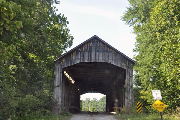 |
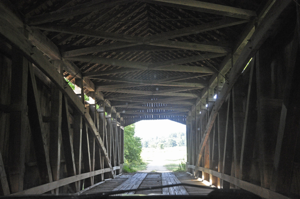
Below:The two RV Gypsies drove their truck through the Nevins Covered Bridge. |
|
 |
|
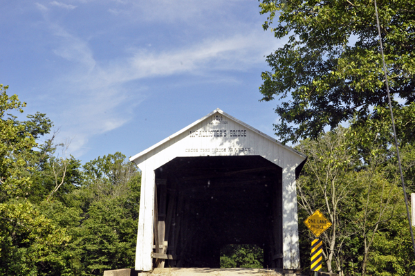
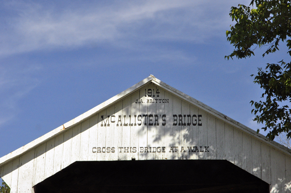
McAllister's Covered Bridge crosses Little Raccoon Creek on County Road East 400 South, in Parke County. This single span Burr Arch Truss structure has a length of 126 feet, or 144 feet including the 9-foot overhang at each end, is 16 feet wide and 14 feet high. Built in 1914 by Joseph A. Britton and Son, though no historical marker is present, it was listed on the National Register of Historic Places in 1978. McAllister Covered Bridge is listed in the 1989 "World Guide to Covered Bridges," published by The National Society for the Preservation of Covered Bridges, Inc., as #14-61-16; however, the designation used by Parke County officials is #14-61-11 ... in the February 1938 "Indiana History Bulletin" Robert B. Yule and Richard C. Smith assigned the designation "eu" for this Covered Timber Bridge located between Section 28 and 33, Township 15 North, and Range 7 West, 2-1/2 miles northeast of Catlin. |
|
| Above quote from http://www.countyhistory.com/coveredbridge/parke/mcallister.htm | |
 |
 |
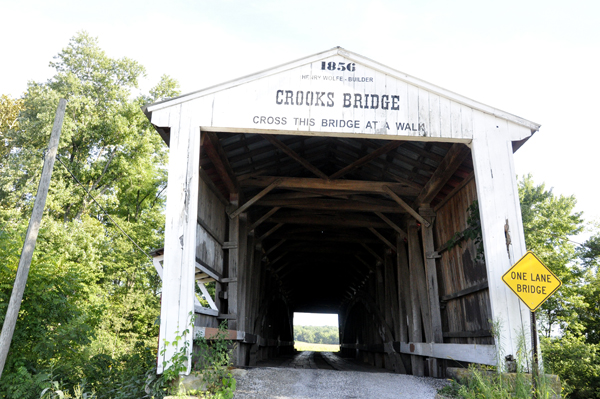
The Crooks Covered Bridge, originally known as the Walker Adams Covered Bridge, currently crosses Little Raccoon Creek on County Road South 275 East at County Road South 225 East, in Parke County. This single span Burr Arch Truss structure has a length of 132 feet, or 154 feet including the 11-foot overhang at each end, with a portal clearance 14 feet wide by 13 feet high. First built in 1855-56 by Henry Wolf, the road that the bridge sat on was abandoned in 1863 and the structure was taken down. There is considerable confusion about this phase of the bridge's life as some say it was washed down stream where it was raised and receive a new foundation while others say the creek changed course necessitating the move. According to Bob McElwee in "Bridges to the Past" General Arthur Patterson rebuilt the bridge in 1867 at Darroch's Site which had been selected by J. J. Daniels, who had been commissioned to rebuild the bridge. Crooks Covered Bridge is the oldest of its kind in Parke County still resting on its original "hewn" stone foundation and, though no historical marker is present, it was listed on the National Register of Historic Places in 1978.Crooks Covered Bridge is listed in the 1989 "World Guide to Covered Bridges," published by The National Society for the Preservation of Covered Bridges, Inc., as #14-61-17; however, the designation used by Parke County officials is #14-61-12. |
|
 |
 |
Although Crooks Bridge is open for drive-through traffic, Karen Duquette walked in it and took photos of Little Raccoon Creek from the window on each side of the bridge. No other traffic nor people were in the area at the time. Notice that all of the drive-through covered bridges are one-lane bridges, but accept two-way traffic. However, they are all short bridges and it is easy to see if there is on-coming traffic and if it is safe to enter the bridge or not. |
|
 |
 |
Below: Lee Duquette waited in the truck and checked the route on the map, while Karen Duquette took photos. |
|
 |
|
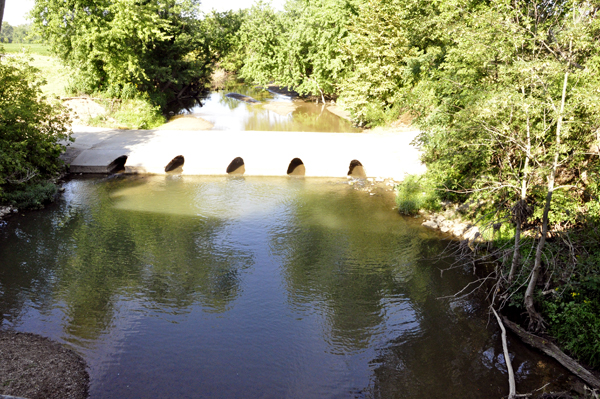
Below is an unnamed covered bridge at the Ernie Pyle Rest Area. This bridge does not show upon the covered bridge driving tour map. It was obviously open only to pedestrian traffic, because the road runs alongside of the bridge, not through the bridge. |
|
 |
 |
 |
 |
 |
|
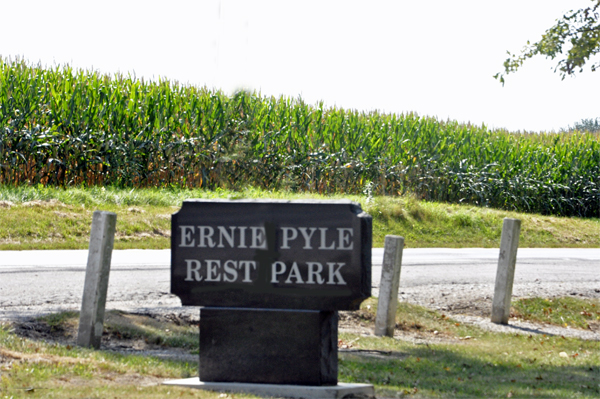
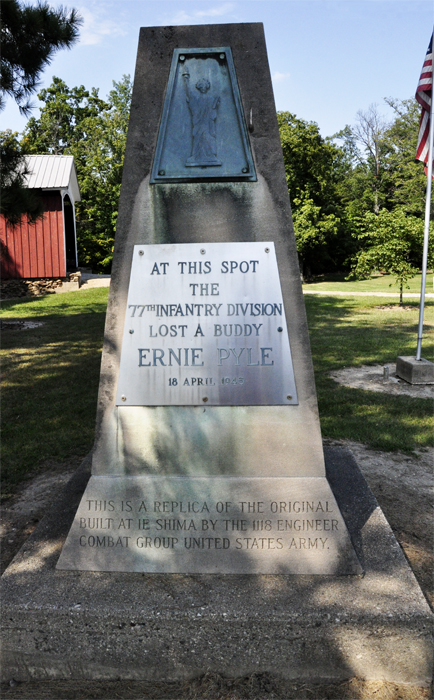
Below: This rest stop is two miles away from the small town of Dana, Indiana, the home of famous war correspondent Ernie Pyle, killed in battle in Le Shima, an island off of Okinawa Honto. A monument stands at the rest stop by the covered bridge. |
|
 |
|
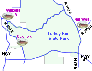
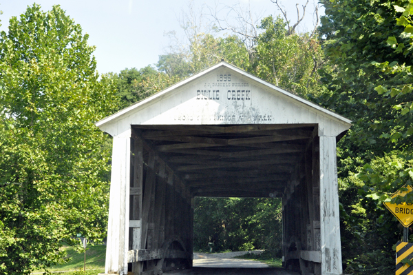
Below: Billie Creek Covered Bridge crosses Williams Creek, in Billie Creek Village, Parke County. This single span Burr Arch Truss structure has a length of 62 feet, or 78 feet including the 8-foot overhang at each end, with portals that are 15 feet wide by 12 feet 6 inches high. Joseph J. Daniel built the Billie Creek Covered Bridge in 1895, and though no historical marker is present, it was added to the National Register of Historic Places in 1978. Billie Creek Covered Bridge is listed in the 1989 "World Guide to Covered Bridges," published by The National Society for the Preservation of Covered Bridges, Inc., as #14-61-19; however, the designation used by Parke County officials is #14-61-39. |
|
| above quote from http://www.countyhistory.com/coveredbridge/parke/billiecreek.htm | |
The Billie Creek Covered Bridge is a bridge that cars can still drive through, so even though there was not other traffic in the area, the two RV Gypsies just took one quick photo as they entered the bridge in their truck. |
|
 |
|
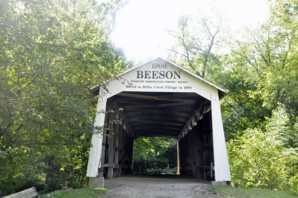
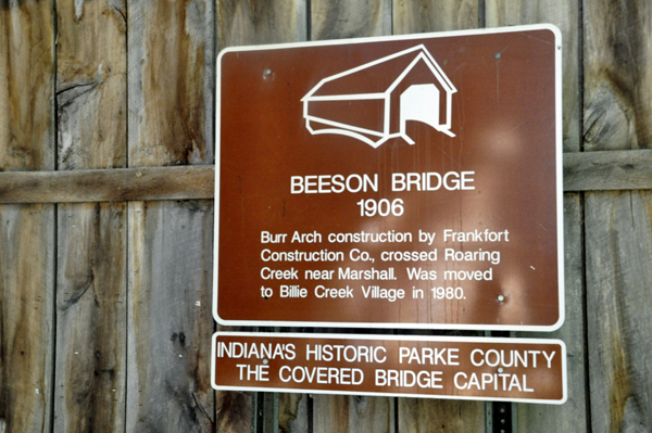
Below: Beeson Covered Bridge originally crossed Roaring Creek, on County
Road North 200 East, in Parke County. This single span Burr Arch Truss
structure has a length of 55 feet, or 71 feet including the 8-foot overhang
at each end, with portals that are 16 feet wide by 13 feet high. Built
in 1906 by the Frankfort Construction Company, it may have received
its name from the contractor of the original road it occupied for so
many years. |
|
In the spring of 1980, the Beeson Covered Bridge was moved to Billie Creek Village in Section 8, Township 15 North, and Range 7 West, where it has been restored and now crosses Williams Creek. The Beeson Covered Bridge was added to the National Register of Historical Places in 1978. Beeson Covered Bridge is listed in the 1989 "World Guide to Covered Bridges," published by The National Society for the Preservation of Covered Bridges, Inc., as #14-61-24; however, the designation used by Parke County officials is #14-61-38 ... in the February 1938 "Indiana History Bulletin" Robert B. Yule and Richard C. Smith assigned the designation "nw" to this Covered Timber Bridge located between (original) Sections 5 and 4, Township 16 North, and Range 7 West, about 1 mile northwest of Marshall. |
|
| http://www.countyhistory.com/coveredbridge/parke/beeson.htm | |
 |
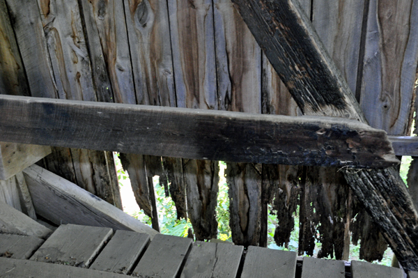 |
The Beeson Covered Bridge is open ONLY to pedestrian traffic. And as shown in the above photo, it is in need of repair. |
|
 |
|
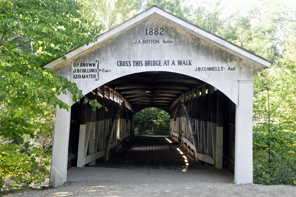
Below: As the two RV Gypsies drove to the Narrows Covered Bridge, they saw "no parking signs" on both sides of the bridge. They think this meant no parking on the nearby roadside bridge. So they parked their car on the street area and walked down the stairs to the Narrows Covered Bridge. |
|
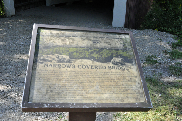
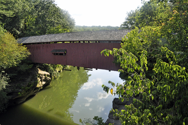
The Narrows Covered Bridge crosses Sugar Creek in Turkey Run State Park, on its eastern boarder, in Section 26, Township 17 North, and Range 7 West, in Parke County. This single span Burr Arch Truss structure has a length of 121 feet, or 141 feet including the 10-foot overhang at each end, is 16 feet 6 inches wide and 12 feet 6 inches high. Built in 1882 (or 1883) by Joseph A. Britton, near the site where the Lusk Mill once stood, this structure was bypassed in 1960. Though no historical marker is present, the Narrows Covered Bridge was listed in the National Register of Historic Places in 1978. Narrows Covered Bridge is listed in the 1989 "World Guide to Covered Bridges," published by The National Society for the Preservation of Covered Bridges, Inc., as #14-61-36; however, the designation used by Parke County officials is #14-61-37. |
|
| Above quote from: http://www.countyhistory.com/coveredbridge/parke/narrows.htm | |
 |
 |
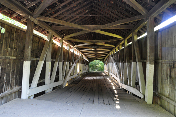
Below: The Narrows Covered Bridge is open only to pedestrian traffic. |
|
 |
 |
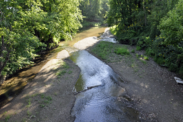
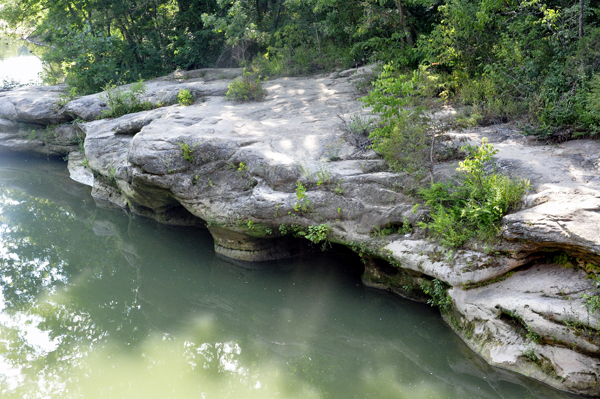
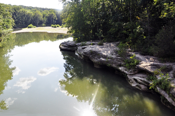
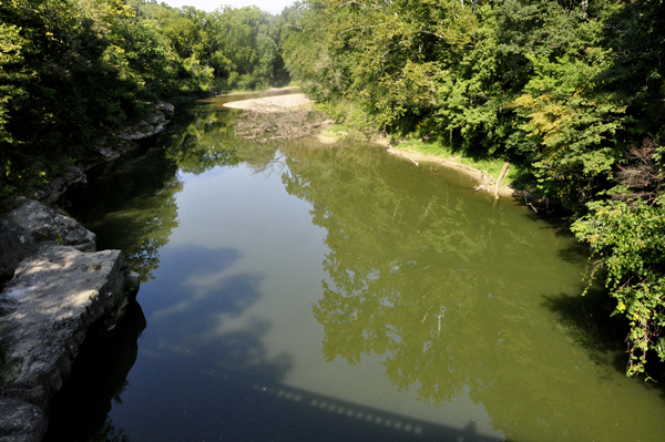
Below: View of Sugar Creek taken from each side of the covered bridge. |
|
 |
 |
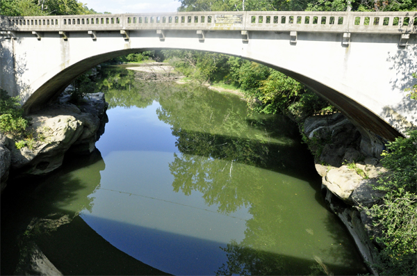
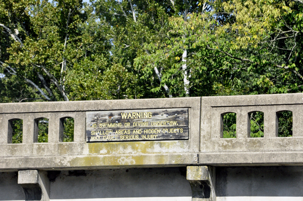
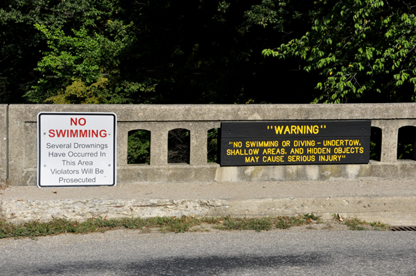
Below: Looking from the Narrows Covered Bridge to the parallel roadside bridge with its no swimming or diving sign. |
|
 |
 |
Below: Standing on the roadside bridge and looking down from there into the water, the two RV Gypsies had to wonder why people took the chance on injury or death by diving from this bridge or swimming here. It could lead to a very tragic loss. |
|
 |
 |