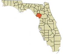
Chiefland is a city in Levy County, Florida that calls itself the "Gem of the Suwannee Valley" and was incorporated in 1929. A village of the Timucua people was once located south of the present city and at Manatee Springs. The area's economy was traditionally based on agriculture, primarily farming (peanuts, watermelons, hay); ranching (cattle, hogs); dairy (milk); timber (pulpwood, lumber, turpentine) and aquaculture (fishing, oystering, crabbing). Manatee Springs State Park is located 6 miles west of town. The crystal-clear water is a "first-magnitude" spring that flows directly into the Suwannee River. The park offers a full slate of activities, including camping. Manatees can be seen in the spring year-round, but especially in late fall and winter, where the constant 72 degrees F temperature of the spring is much warmer than river water. |