The Two RV Gypsies: Full-Time RVers
learned interesting facts about
Yosemite National Park
Yosemite National Park is located in the eastern portions of Toluene, Mariposa and Madera counties in east central California, United States. The park covers an area of 761,266 acres or 1,189 square miles and reaches across the western slopes of the Sierra Nevada mountain chain. Designated a World Heritage Site in 1984, Yosemite is internationally recognized for its spectacular granite cliffs, waterfalls, clear streams, Giant Sequoia groves, and biological diversity. Almost 95% of the park is designated wilderness.

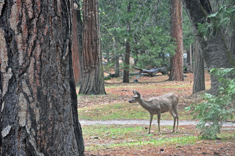
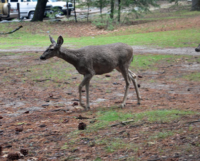
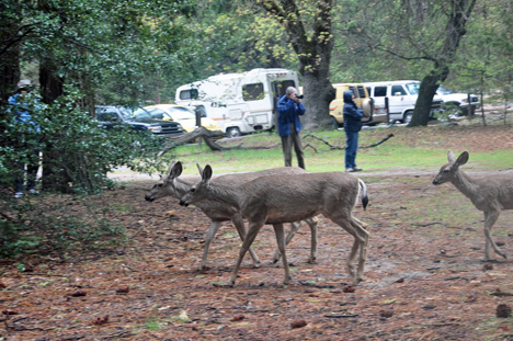
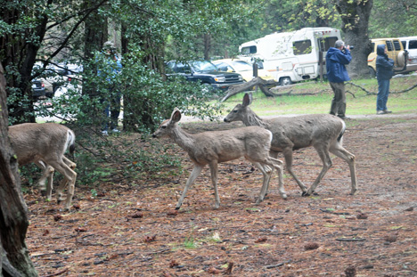
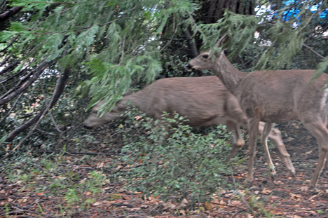
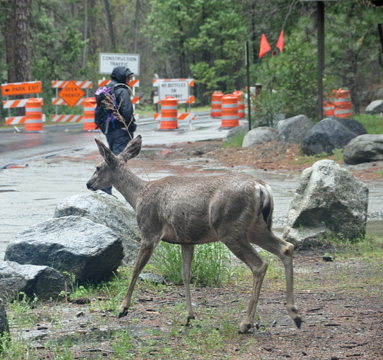
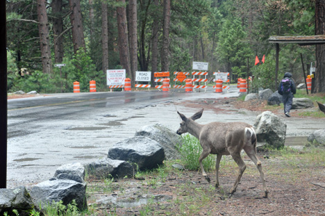
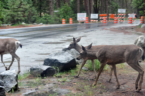
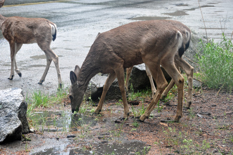
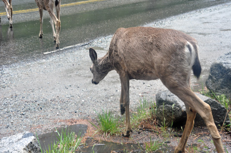
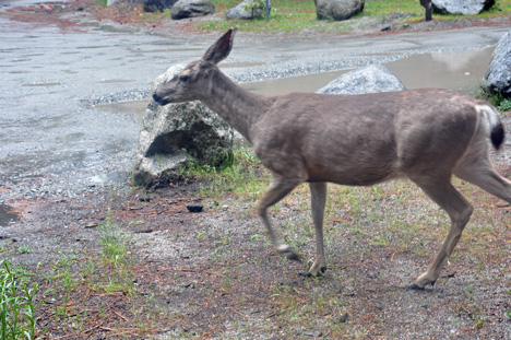
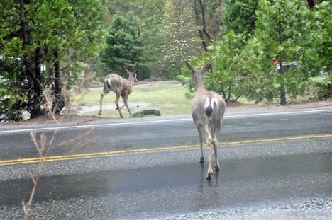
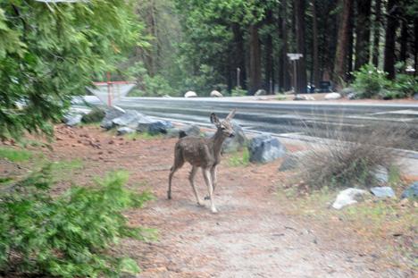
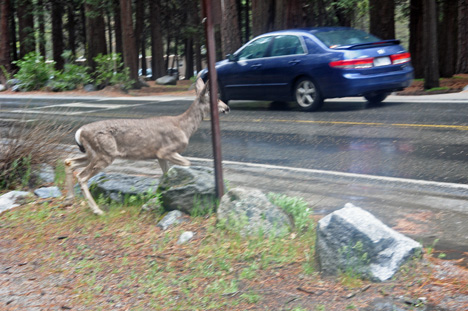
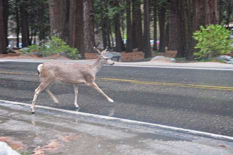
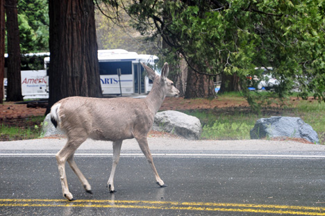
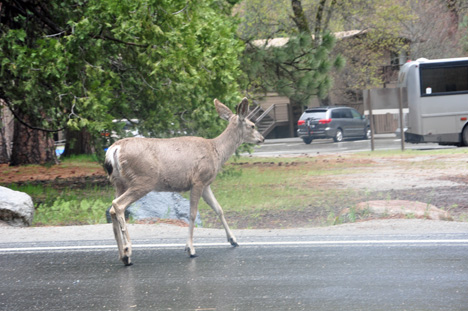
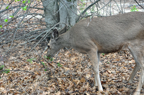
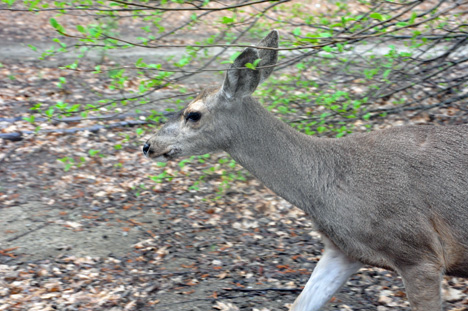
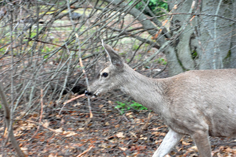
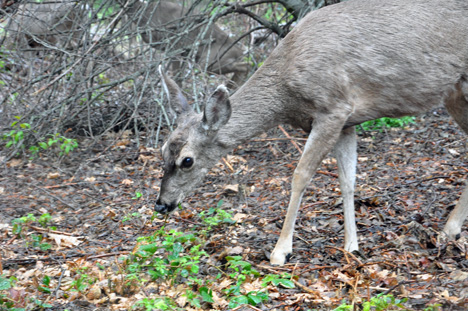
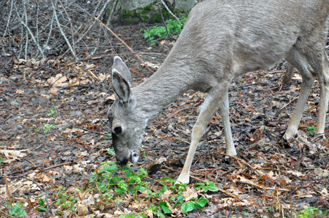
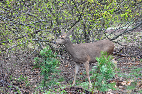
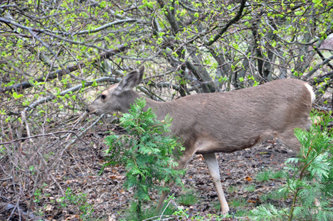
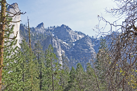
Yosemite is one of the largest and least fragmented habitat blocks in the Sierra Nevada, and the park supports a diversity of plants and animals. The park has an elevation range from 2,000 to 13,114 feet and contains five major vegetation zones: chaparral/oak woodland, lower montane, upper montane, subalpine, and alpine. Of California's 7,000 plant species, about 50% occur in the Sierra Nevada and more than 20% within Yosemite. There is suitable habitat or documentation for more than 160 rare plants in the park, with rare local geologic formations and unique soils characterizing the restricted ranges many of these plants occupy.

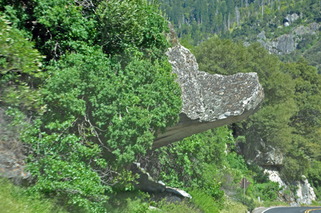
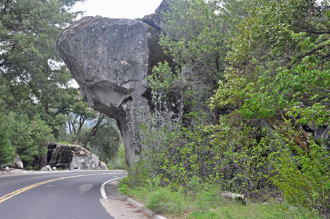
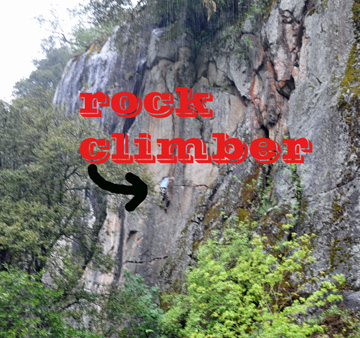
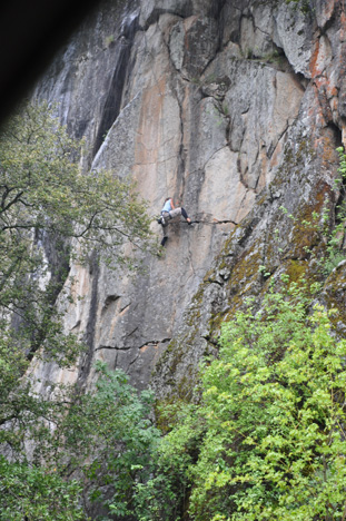
The geology of the Yosemite area is characterized by granite rocks and remnants of older rock. About 10 million years ago, the Sierra Nevada was uplifted and then tilted to form its relatively gentle western slopes and the more dramatic eastern slopes. The uplift increased the steepness of stream and river beds, resulting in formation of deep, narrow canyons. About 1 million years ago, snow and ice accumulated, forming glaciers at the higher alpine meadows that moved down the river valleys. Ice thickness in Yosemite Valley may have reached 4,000 feet during the early glacial episode. The downslope movement of the ice masses cut and sculpted the U-shaped valley that attracts so many visitors to its scenic vistas today.
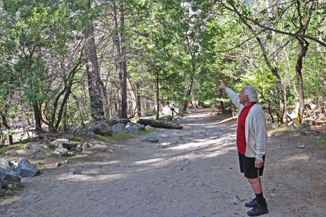
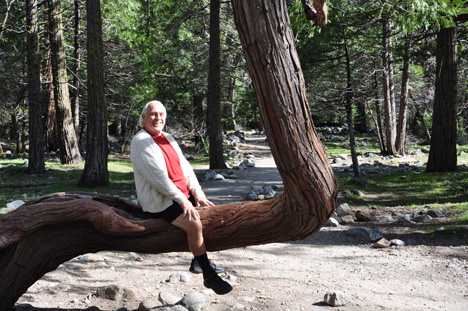
sign - Yosemite National Park
Below: The road entering Yosemite National Park
The road entering Yosemite National Park
Below: Two sides of one rock formation hanging over the road. The view on the left looks like a bear's snout.
a rock formation over the road
Below: Beautiful scenery within Yosemite National Park
scenery within Yosemite National Park
Lee Duquette admiring the scenery within Yosemite National Park
Below: Daytime photo of the moon and trails from jets
the moon and trails from jets
trails from jets in the sky
Below: Karen Duquette checked out the small round rock that was balancing on a bigger rock and discovered that it was NOT attached. She was surprised that it stayed there and never rolled off.
Karen checks out a small round rock
Below: laughing clipart dudeLee Duquette thought he was riding a horse - until Karen Duquette told him that it did not move! "Duh" he said.
Lee thinks he is riding a horse
a bird
Below: Cool shots of a waterfall and the Merced River
cool shots of a waterfall and river
Below: A rock climber
a rock climber
a rock climber
Below: The Merced River's headwaters are in the southern half of Yosemite National Park. The river flows into Yosemite Valley. Much of the water is stored behind the New Exchequer Dam in Lake McClure, and diverted by the Merced Irrigation District at the Crocker-Huffman Diversion Dam. The remainder of the water flows southwest through foothills, and then across the San Joaquin Valley to join the San Joaquin River.

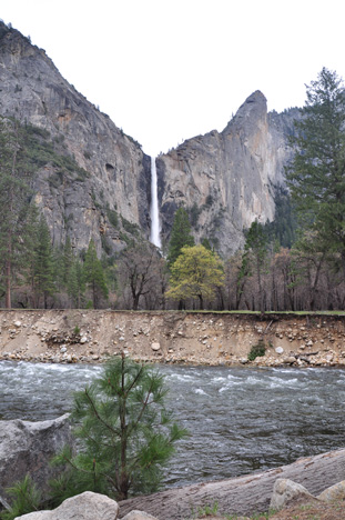
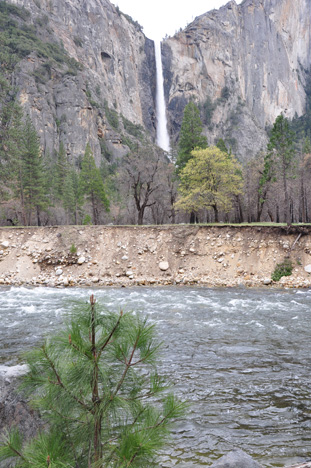
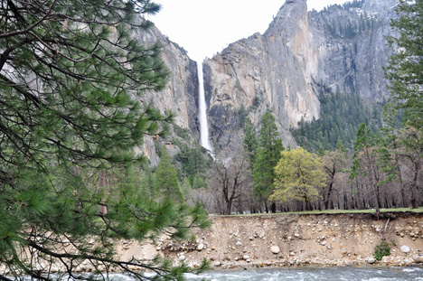
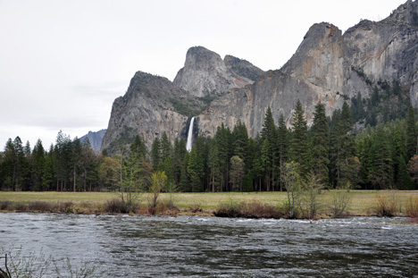
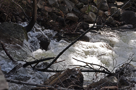
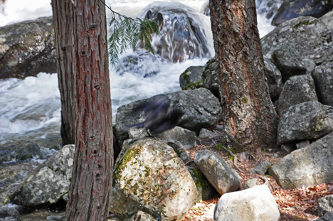
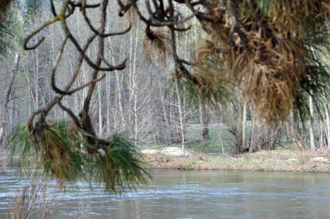
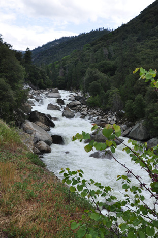
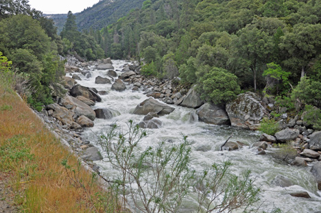
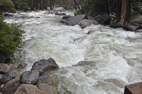
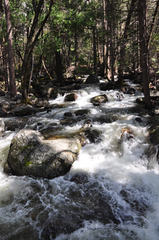
The Merced River is protected under the National Wild and Scenic Rivers Act. It is free flowing until Lake McClure tends to flood in the winter and spring, and then reduce to a mere trickle in the late summer and fall. In April and May, the Class III-IV Whitewater on the Merced is first class, the stuff of avid paddlers and winter daydreams. For the rest of the Whitewater season, the Merced churns with bold wave trains and slick chutes friendly to rafters of all levels.
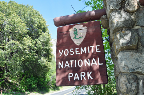
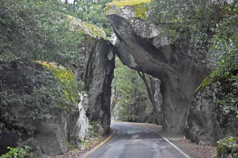
Highway 140 runs along part of the Merced River and is the main road into Yosemite National Park.

the Merced River
the Merced River
the Merced River
the Merced River
the Merced River
the Merced River

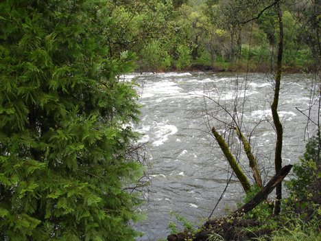
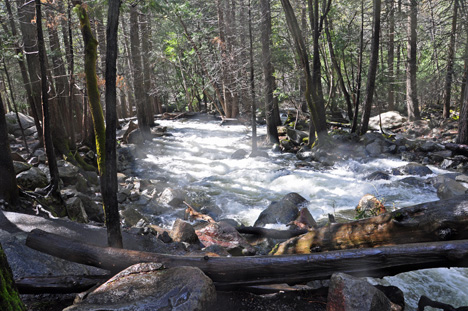
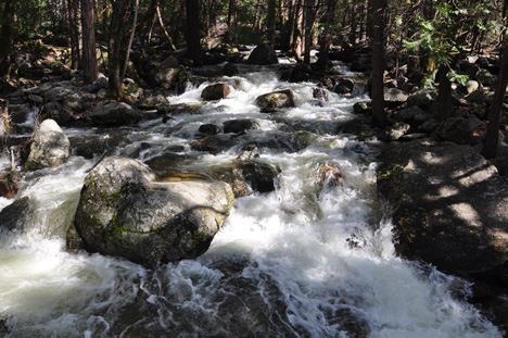
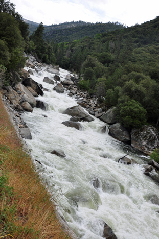
Did You Know? The Merced River was designated a National Wild and Scenic River in 1987. Eighty-one miles of river runs through Yosemite National Park, including a stretch in Yosemite Valley.

the Merced River
the Merced River
the Merced River
Flood of the century sign
Below: Flood Waters previously undercut this road (where Karen Duquette stood to take the below photos) and washed out a section 8 feet wide, 70 feet deep, and the length of a football field. The Merced River winds through a steep, rocky canyon between Yosemite Valley and El portal, dropping an average of 350 feet in elevation per mile. During the 1997 flood, the water rose to 30 feet above the riverbed, undercutting El Portal Road.
the Merced River
the Merced River
the Merced River
Below: Deer in Yosemite National Park wanted to cross the road, and in doing so, several of them almost ran right into Karen Duquette. (Karen was standing there BEFORE the deer came through). So she stood still to photograph them. Then she followed the deer across the street, through a parking lot (while keeping at a safe distance), to a field where the deer stopped to eat the grass. Then Karen got some real close up photos (while standing behind a tree) while Lee filmed the deer with the video camera. The two RV Gypsies always give wildlife their space.
deer
deer
deer
deer
deer
deer
deer
deer
deer drinking water
deer
deer running
deer crossing road
deer
deer
deer
deer
deer
deer
deer
deer
deer eating grass
deer
deer
deer eating grass
deer
deer
deer
Menu for the two RV Gypsies in California - April 2009

California photos are in 28 separate sections found below. Some sections may have more than one page so that the photos will upload faster. You may visit these sections in any order you choose. Each section will have this menu so that visitors do not have to keep returning here in order to continue the California adventures. There is also a link to Oregon at the very bottom of the California menu.

travel scenery
Mountain Lakes RV Park
Venice Beach
Big Bear Mountain (4 pages)
Palm Springs Tram (3 pages)
Karen's family photos

Kaweah Park Resort and a bobcat

Three Rivers and Lake Kaweah

driving scenery

Sequoia National Park (3 pages)

Kings Canyon
- big sequoia trees

Yosemite National Park (this page)

El Capitan

Bridalveil and Yosemite Falls

Indian Flat RV Park

The Golden Gate Bridge

Fisherman's Wharf /
Seals / Alcatraz

Armstrong Woods
State Preserve -
Giant Redwood Trees

Sonoma County driving tour / beaches

San Francisco
and cable car ride

The Living Roof
and Gardens

Chinatown

N. Petaluma KOA
and driving scenery

Bear Mountain RV Resort

Shasta Lake

Mt. Shasta

Shasta Dam


Sundial Bridge

 
look below for more menu options

go to the next adventure of the two RV Gypsies AFTER you have enjoyed all of the above, please continue on to Oregon.

OR Continue navigation of this large website via the buttons below.

search for items on this webpage beginning with the letter A search for things on this website beginning with the letter B search for things/places on this website starting with the letter C search for things/places on this website starting with the letter D search for things/places on this website starting with the letter E search for things/places on this website starting with the letter F search for things/places on this website starting with the letter G search for things/places on this website starting with the letter H search for things/places on this website starting with the letter I search for things/places on this website starting with the letter J search for things/places on this website starting with the letter K search for things/places on this website starting with the letter L search for things/places on this website starting with the letter M search for things/places on this website starting with the letter N search for things/places on this website starting with the letter O visit places the two RV Gypsies have been that start with the letter P search for things/places on this website starting with the letter P search for things/places on this website starting with the letter R search for things/places on this website starting with the letter S search for things/places on this website starting with the letter T search for things/places on this website starting with the letter U search for things/places on this website starting with the letter V search for things/places on this website starting with the letter W search for things/places on this website starting with the letter Y search this website for things/places starting with the letter Z such as ziplines find anything starting with the letter Q on this website
photos/history Alaska from the two RV Gypsies
photos/history in Canada from the two RV Gypsies
TOC-Countries and Cruices
Cruises
photos/history of continental USA by the two RV Gypsies
how Karen & Lee Duquette became two RV Gypsies
learn about Brian Lee Duquette
e-mail the two RV Gypsies
Flashback to the past
please sign the guestbook of the two RV Gypsies
go to webpage built by Karen plus other RV pages
helpful hints for RVers
Art, carvings, murals, sculptures
Caampgrounds the two RV Gypsies stayed in
Gardens the two RV Gypsies visited
Lighthouses the two RV Gypsies visited
Museums the two RV gypsies have visited
National Parks the two RV Gypsies visited
Oddities seen by the two RV gypsies
Restaurants the two RV Gypsies have visited
State Parks the two RV gypsies visited
Videos taken by the two RV Gypsies
Waterfalls the two RV gypsies have visited
Wildlifethe two RV gysies have seen