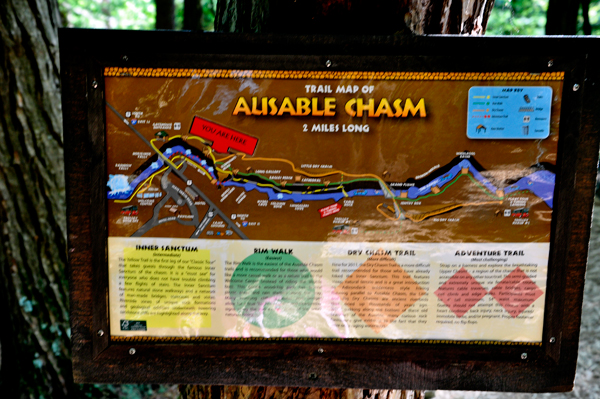
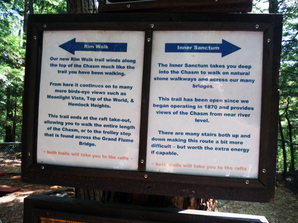
There are four trails at Ausable Chasm: The Rim Walk is the easiest; a casual walk on a gentle woodchip path with picnic areas and rain shelters along the way, plus stunning cliff-side vistas and bridges for a bird's -eye-view.
The Inner Sanctum Trail is the intermediate trail through the famous Inner Sanctum of the chasm. It has several flights of stairs throughout the chasm, natural stone walkways and a network of man-made bridges, staircases and vistas, plus riverside views of unique rock formations and geological oddities underneath towering sandstone cliffs. This is the path the two RV Gypsies took.
The Dry Chasm Trail(new in 2011) is more difficult. It features steep, natural terrain and Adirondack wilderness style hiking as it runs parallel to Ausable Chasm, the Little and Big Dry Chasms.
The Adventure Trail is challenging. Adventure seekers are strapped into a harness on a semi-guided course featuring cable traverses, cable bridges, and a cargo net climb and edge walks. Restrictions for guests apply. |
|
|
Since 1870, Ausable Chasm has thrilled and amazed many who have come to explore. The two RV Gypsies are blessed to be able to live the lifestyle of RV Gypsies and travel in their RV to witness what Mother Nature has provided here: a uniquely-carved, vertical-walled canyon made of 500 million year old rock! (And all the other amazing places in the USA).
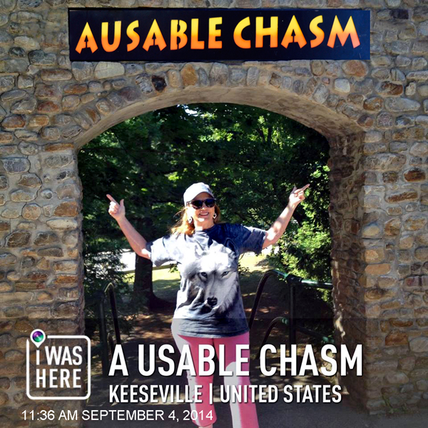
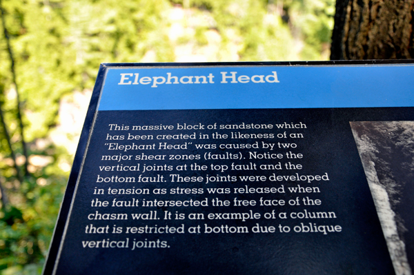
After paying an admission fee and getting a paper bracelet that indicates
which tour they have paid for, the two RV Gypsies made their first stop,
as directed, at "Elephant's Head". |
|
 |
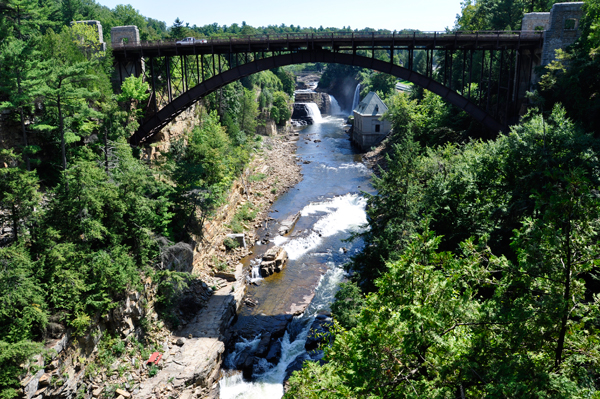
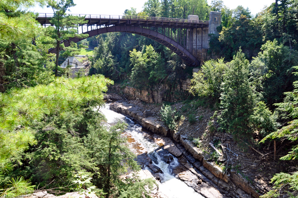
Then the two RV Gypsies walked across the Route 9 bridge that spans the upper portions of the Chasm.
 The bridge was built in 1925 by Burr M Stark, engineered by C.C. MacCloskey and in 1999 it was added on the National Register of Historic Places. Its purpose was mainly for transportation connecting points north such as Plattsburgh and Montreal to points south such as Albany and New York City. Route 9 was the only major route connecting these population centers as Interstate 87 was yet to be constructed (completed in 1967). Prior to the current Route 9 Bridge was the railroad bridge that served as a means to cross the Ausable River/Chasm on route from Port Kent, NY (3 miles away on Lake Champlain) to Keeseville, NY. The Peanut Railroad was the line that operated on the tracks and was in use for a very short time in the early 1900's. Remnants of the railroad bridge (foundation) were still visible below the current bridge. The bridge was built in 1925 by Burr M Stark, engineered by C.C. MacCloskey and in 1999 it was added on the National Register of Historic Places. Its purpose was mainly for transportation connecting points north such as Plattsburgh and Montreal to points south such as Albany and New York City. Route 9 was the only major route connecting these population centers as Interstate 87 was yet to be constructed (completed in 1967). Prior to the current Route 9 Bridge was the railroad bridge that served as a means to cross the Ausable River/Chasm on route from Port Kent, NY (3 miles away on Lake Champlain) to Keeseville, NY. The Peanut Railroad was the line that operated on the tracks and was in use for a very short time in the early 1900's. Remnants of the railroad bridge (foundation) were still visible below the current bridge.
|
|
|
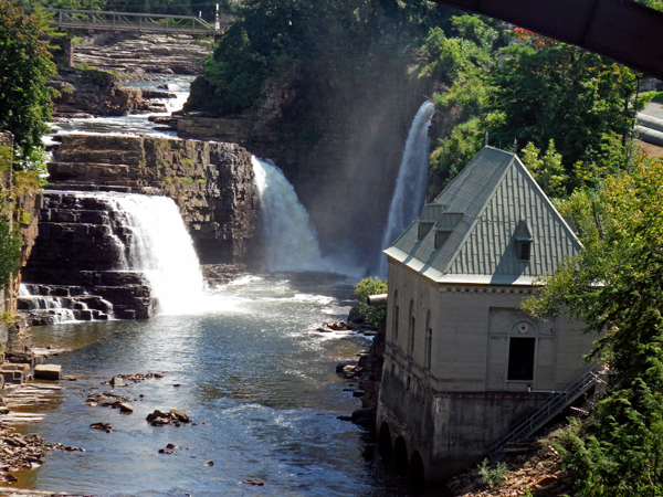
Below: The two
RV Gypsies thought that it was a bit expensive to get in just to view
the falls and chasm and it is even more expensive to take a rafting
or tubing trip on the river, (which they did not do).
There used to be a much better view of these falls from a bridge that
crossed the river below the power house, but it was washed out twice
in the same year by floods so it was not rebuilt. But this is the first
time that the two RV Gypsies have been here, and they liked the views
they got. The view shown below from this area was actually a free area
by the road.
|
|
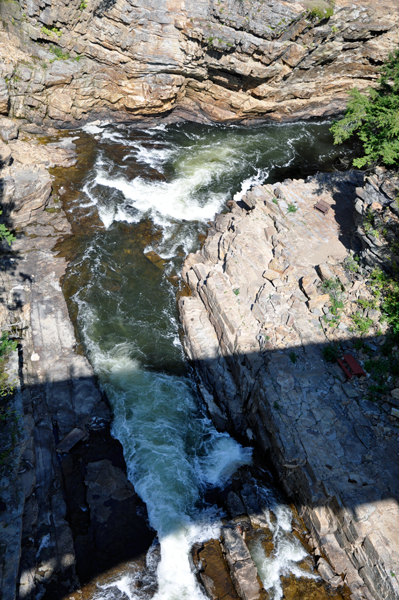
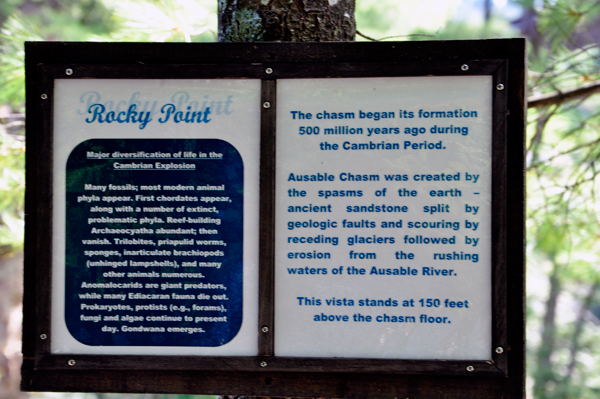
Below: "Rocky Point
Vista" stands at 150 feet above the chasm floor and provided
another view of the Route 9 bridge. |
|
|
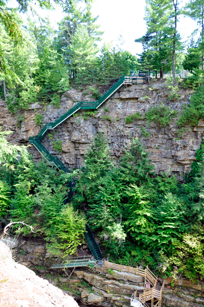
Rocky Point also gave the two RV Gypsies a look at a wild staircase which is only accessed by those on the challenging Adventure Trail described above. |
|
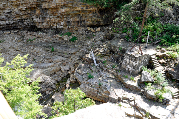
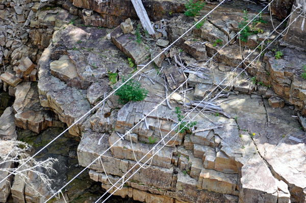
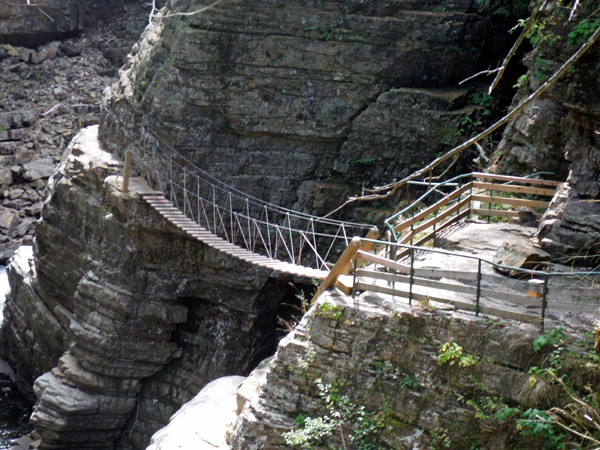
The rope bridge shown below was part of the challenging Adventure Trail; a route that is definitely NOT something the two RV Gypsies wanted to do. |
|
|
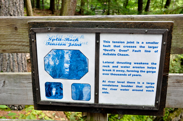
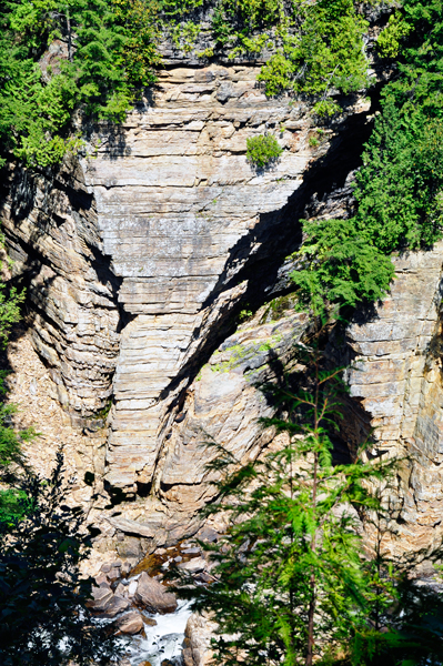
Below: Split-Rock Tension
Joint is a smaller fault that crosses the larger "Devil's
Oven" fault line of Ausable Chasm. Lateral thrusting
weakens the rock and water erosion helps break it away, forming the
gorge over thousands of years. |
|
 |
|
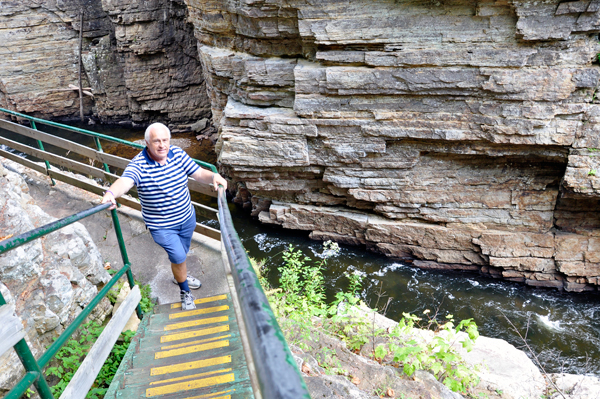
Below: Signs showing the different trails at the 2-mile long Ausable Chasm. The two RV Gypsies chose the Inner Sanctum trail, even though it involved lots of stairs. |
|
|
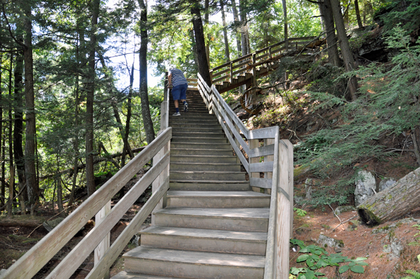
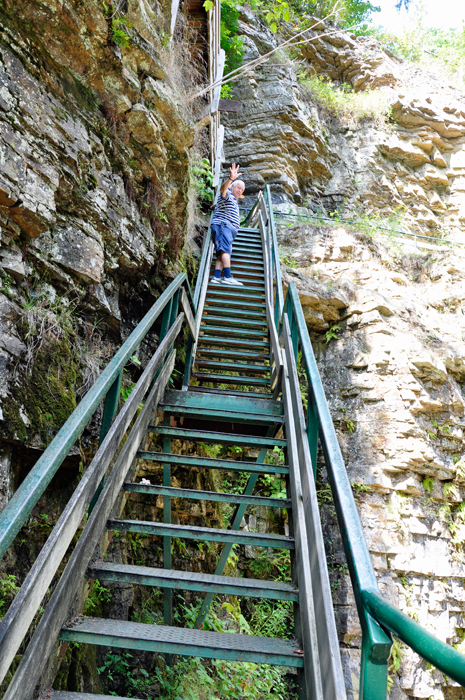
It has only been 9 months since Lee Duquette had both his knees replaced, so he still found it easier to go down stairs backwards because that puts less pressure on his knees. Karen Duquette paused part way down the stairs to photograph Lee.
|
|
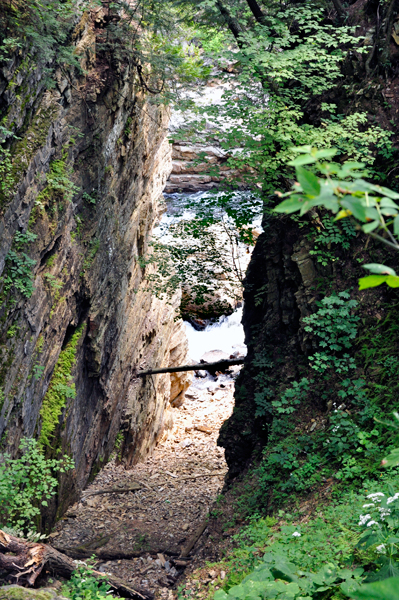
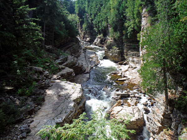
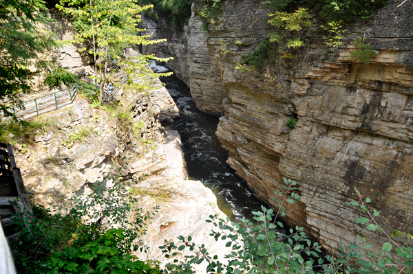
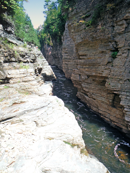
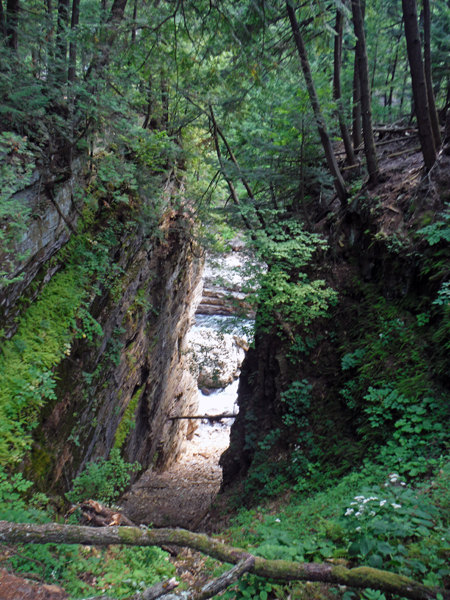
Below: Views from the Inner Sanctum trail. |
|
|
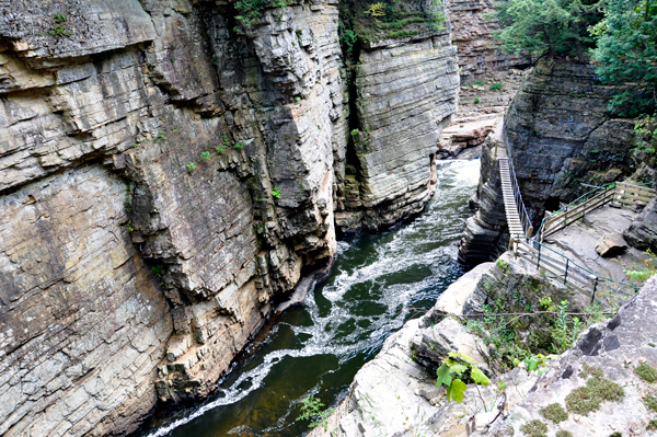
Below: The two RV Gypsies
tackled the stairs down to an area called the "Punch Bowl".
And yes, after a brief look there, they had to climb back up the same
set of stairs. Karen Duquette is not sure exactly why it is called the
"Punch Bowl". |
|
|
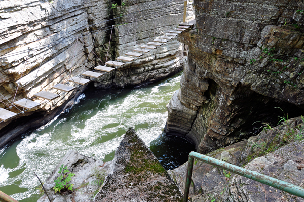
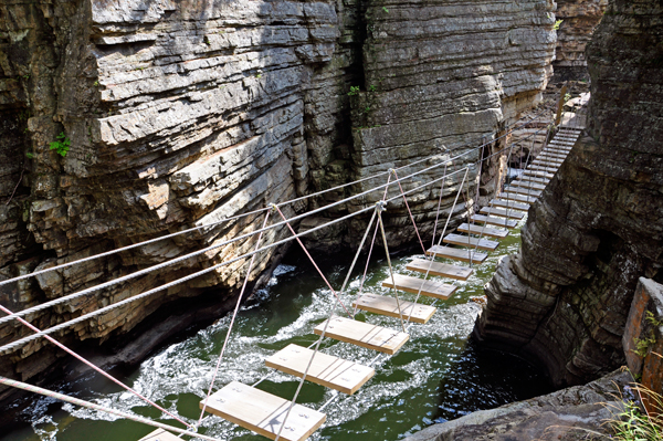
Below: The two
RV Gypsies studied the suspension bridge, which did not look like an
easy bridge to cross, so they did not go on the suspension bridge. They
did not see anyone else on it either. They are pretty sure that this
bridge will move as anyone walks across it. The two RV Gypsies have
walked on swinging suspension bridges in the past, but it is not something
they really like to do. |
|
Below; After viewing Punch
Bowl and the suspension bridge, the two RV Gypsies climbed back
up the stairs to the nearby area labeled "Table Rock".
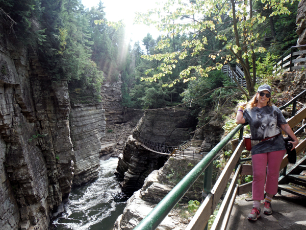
Below is a photo of Karen Duquette at "Table Rock",
and the view behind her is the rope bridge and "Punch Bowl"
area shown above. |
|
Below are more views of the Punch Bowl lookout as seen from Table Rock. |
|
|
Below: Lee Duquette at Table Rock, and the view looking down from Table Rock, away from the Punch Bowl area. |
|
|
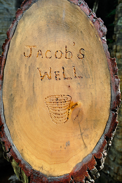
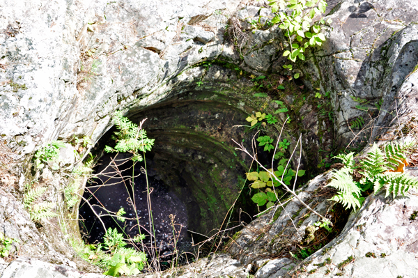
Unfortunately, NONE of the
brochures the two RV Gypsies received at the Welcome Center told much
about the various formations. The two RV Gypsies would like to know
more about Jacob's Well, which shown below. |
 |
 |
 Please
continue on to Page 2 of Ausable Chasm- photos have been divided
into two pages to allow photos to upload faster, and make your viewing
of these pages more enjoyable. Please
continue on to Page 2 of Ausable Chasm- photos have been divided
into two pages to allow photos to upload faster, and make your viewing
of these pages more enjoyable.
|